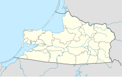
Mamonovo (Russian: Мамоново, German: Heiligenbeil,[7] Polish: Święta Siekierka[2] or Świętomiejsce, Lithuanian: Šventapilė)[8] is a town in Kaliningrad Oblast, Russia, near the border with Poland. Population figures: 7,761 (2010 Census);[3] 7,393 (2002 Census);[9] 7,816 (1989 Soviet census).[10]
Mamonovo
Мамоново | |
|---|---|
Water tower in Mamonovo | |
| Coordinates: 54°27′50″N 19°56′29″E / 54.46389°N 19.94139°E | |
| Country | Russia |
| Federal subject | Kaliningrad Oblast[1] |
| Founded | 1301 (Julian) |
| Town status since | 1301[2] |
| Elevation | 15 m (49 ft) |
| Population | |
• Total | 7,761 |
| • Subordinated to | town of oblast significance of Mamonovo[1] |
| • Capital of | town of oblast significance of Mamonovo[1] |
| • Urban okrug | Mamonovsky Urban Okrug[4] |
| • Capital of | Mamonovsky Urban Okrug[4] |
| Time zone | UTC+2 (MSK–1 |
| Postal code(s)[6] | 238450 |
| OKTMO ID | 27712000001 |
Etymology
editMamonovo is named after a Soviet Commander, Nikolay Vasilyevich Mamonov, killed in action near Pułtusk on October 26, 1944, who was posthumously awarded the title Hero of the Soviet Union on March 24, 1945.
History
editUnder the Teutonic Knights Heiligenstadt was built near an Old Prussian settlement. It was granted town rights in 1301.[2] It was later renamed Heiligenbeil after a holy axe used by Augustinian monks, established in the area by Grand Master Winrich von Kniprode after the Battle of Rudau, to cut down an oak tree worshiped by pagan Prussians.[11] It came under the bishopric of Warmia, then to the territory of Natangia. Since 1440, the town was a founding member of the anti-Teutonic Prussian Confederation, upon the request of which, Polish King Casimir IV Jagiellon incorporated the region and town to the Kingdom of Poland in 1454.[12] Then the Thirteen Years' War, the longest of all Polish–Teutonic wars, broke out, after which the region and town became part of Poland as a fief held by the Teutonic Knights,[13] and after 1525 held by secular Ducal Prussia. The area was home to a mixed population with several villages founded by the Poles in the 15th century.[2]
From 1701, the town was part of the Kingdom of Prussia. From 1758 to 1762 it was occupied by Russia during the Seven Years' War, then restored to Prussia, and from 1871 it was also part of Germany, within which it was located in the province of East Prussia. In the late 19th century, the inhabitants were mostly employed in farming and cattle and horse breeding.[2] The town sold sizable amounts of barley, rye and oats to Silesia, Saxony and Berlin, and flour to Gdańsk, Brunswick, Berlin and surrounding towns.[2]
During World War II, in 1944–1945, it was the location of the Heiligenbeil concentration camp, a subcamp of the Stutthof concentration camp, in which the Germans imprisoned around 1,100 Jewish women and 100 Jewish men as forced labour.[14] There were also forced labour camps for French POWs and Russians.[15] Towards the end of the war in fierce fighting between January and March 1945 the Heiligenbeil pocket fell to the Red Army. It was captured by Red Army on March 26, 1945, and was soon integrated into the Kaliningrad Oblast. It took its present name in 1946. The defending 4th Army's archives were buried in a forest near the town and found in 2004, in an area still littered with debris from the final battles.[16]
Administrative and municipal status
editWithin the framework of administrative divisions, it is, together with four rural localities, incorporated as the town of oblast significance of Mamonovo — an administrative unit with the status equal to that of the districts.[1] As a municipal division, the town of oblast significance of Mamonovo is incorporated as Mamonovsky Urban Okrug.[4]
Notable people
edit- Rudolf von Auerswald (1795–1866) in 1824 he acquired an estate in the Heiligenbeil District and became Landrat (district administrator)
References
editNotes
edit- ^ a b c d e Resolution #639
- ^ a b c d e f Słownik geograficzny Królestwa Polskiego i innych krajów słowiańskich, Tom XI (in Polish). Warszawa. 1890. pp. 691–692.
{{cite book}}: CS1 maint: location missing publisher (link) - ^ a b Russian Federal State Statistics Service (2011). Всероссийская перепись населения 2010 года. Том 1 [2010 All-Russian Population Census, vol. 1]. Всероссийская перепись населения 2010 года [2010 All-Russia Population Census] (in Russian). Federal State Statistics Service.
- ^ a b c Law #395
- ^ "Об исчислении времени". Официальный интернет-портал правовой информации (in Russian). June 3, 2011. Retrieved January 19, 2019.
- ^ Почта России. Информационно-вычислительный центр ОАСУ РПО. (Russian Post). Поиск объектов почтовой связи (Postal Objects Search) (in Russian)
- ^ M. Kaemmerer (2004). Ortsnamenverzeichnis der Ortschaften jenseits von Oder u. Neiße (in German). ISBN 3-7921-0368-0.
- ^ M. Kiełczewska; Wł. Chojnacki (1946). Okręg Mazurski: mapa komunikacyjno-administracyjna wraz z niemiecko-polskim i polsko-niemieckim słownikiem nazw (Map). 1:500,000 (in Polish). Poznań.
- ^ Federal State Statistics Service (May 21, 2004). Численность населения России, субъектов Российской Федерации в составе федеральных округов, районов, городских поселений, сельских населённых пунктов – районных центров и сельских населённых пунктов с населением 3 тысячи и более человек [Population of Russia, Its Federal Districts, Federal Subjects, Districts, Urban Localities, Rural Localities—Administrative Centers, and Rural Localities with Population of Over 3,000] (XLS). Всероссийская перепись населения 2002 года [All-Russia Population Census of 2002] (in Russian).
- ^ Всесоюзная перепись населения 1989 г. Численность наличного населения союзных и автономных республик, автономных областей и округов, краёв, областей, районов, городских поселений и сёл-райцентров [All Union Population Census of 1989: Present Population of Union and Autonomous Republics, Autonomous Oblasts and Okrugs, Krais, Oblasts, Districts, Urban Settlements, and Villages Serving as District Administrative Centers]. Всесоюзная перепись населения 1989 года [All-Union Population Census of 1989] (in Russian). Институт демографии Национального исследовательского университета: Высшая школа экономики [Institute of Demography at the National Research University: Higher School of Economics]. 1989 – via Demoscope Weekly.
- ^ Urban, William (2006). Samogitian Crusade. Chicago: Lithuanian Research and Studies Center. pp. 158–159. ISBN 0-929700-56-2.
- ^ Górski, Karol (1949). Związek Pruski i poddanie się Prus Polsce: zbiór tekstów źródłowych (in Polish). Poznań: Instytut Zachodni. pp. XXXVII, 54.
- ^ Górski, pp. 96–97, 214–215
- ^ Gliński, Mirosław. "Podobozy i większe komanda zewnętrzne obozu Stutthof (1939–1945)". Stutthof. Zeszyty Muzeum (in Polish). 3: 178. ISSN 0137-5377.
- ^ Megargee, Geoffrey P. (2009). The United States Holocaust Memorial Museum Encyclopedia of Camps and Ghettos 1933–1945. Volume I. Indiana University Press, United States Holocaust Memorial Museum. p. 1459. ISBN 978-0-253-35328-3.
- ^ Koenigsberger Express Das Niemandsland gibt ein Geheimnis preis. Koenigsberger Express, ed. 2004/7
Sources
edit- Правительство Калининградской области. Постановление №640 от 30 августа 2011 г. «Об утверждении реестра объектов административно-территориального деления Калининградской области», в ред. Постановления №877 от 21 ноября 2011 г «О внесении изменения в Постановление Правительства Калининградской области от 30 августа 2011 г. №640». Вступил в силу со дня официального опубликования. Опубликован: "Калининградская правда" (вкладыш "Официально"), №170, 15 сентября 2011 г. (Government of Kaliningrad Oblast. Resolution #640 of August 30, 2011 On the Adoption of the Registry of the Objects of the Administrative-Territorial Divisions of Kaliningrad Oblast, as amended by the Resolution #877 of November 21, 2011 On Amending the Resolution of the Government of Kaliningrad Oblast #640 of August 30, 2011. Effective as of the day of the official publication.).
- Калининградская областная Дума. Закон №395 от 15 мая 2004 г. «О наделении муниципального образования "Город Мамоново" статусом городского округа», в ред. Закона №370 от 1 июля 2009 г «О составе территорий муниципальных образований Калининградской области». Вступил в силу со дня официального опубликования. Опубликован: "Российская газета" ("Запад России"), №115, 3 июня 2004 г. (Kaliningrad Oblast Duma. Law #395 of May 15, 2004 On Granting the Urban Okrug Status to the Municipal Formation of the "Town of Mamonovo", as amended by the Law #370 of July 1, 2009 On the Composition of the Territories of the Municipal Formations of Kaliningrad Oblast. Effective as of the day of the official publication.).


