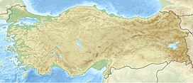
Mount Meydan (Turkish: Meydan Dağı), is an extinct Volcano located in the provincial borders of Van and Ağrı.[1] It is located 7 kilometers northwest of Erciş city. Inside the mountain is a crater and caldera.
| Mount Meydan | |
|---|---|
 Photo of the Meydan Volcano caldera and Gürgürbaba. By NASA. | |
| Highest point | |
| Elevation | 2,328 m (7,638 ft) |
| Prominence | 2778 |
| Coordinates | 39°11′56″N 43°10′55″E / 39.198889°N 43.181989°E |
| Geography | |
| Parent range | Armenian Highlands |
| Geology | |
| Mountain type | Stratovolcano |
Overview
editMeydan Mountain is located at the zero point of the border of Patnos district of Ağrı and Erciş district of Van. Its highest point is 2778 meters with Gürgür Mountain. The base of the caldera is 2320 m. With the collection of surrounding waters in the caldera, the caldera lake was formed. The waters coming out of this lake form the Meydan Stream.[2] Gürgürbaba consists of a relatively soft sloping and symmetrical round dome.[3]
See also
editReferences
edit- ^ "Coğrafi Özellikler". ercis.gov.tr. Erçiş Kaymakamlığı.
- ^ "Meydan Kalderası ve Gürgürbaba Domu Çevresinin Jeomorfolojik Özellikleri" (in Turkish). Ankara Üniversitesi Türkiye coğrafyası araştırma ve uygulama merkezi, Turkish Journal of Geographical Sciences. October 17, 2019. Archived from the original on December 14, 2019.
- ^ "Identification, caractérisation et mise en place des gisements d'obsidienne de quatre complexes volcaniques en Anatolie orientale, dans le cadre des études de provenance au Proche-Orient" (PDF) (in French). Paris 1 Panthéon-Sorbonne University. January 18, 2019. p. 85.
