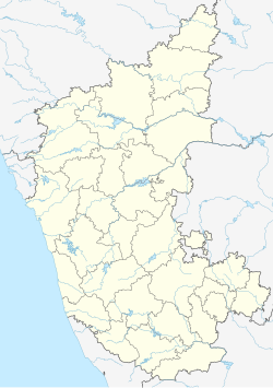
Somwarpet (somavārapēte, also written Somvarpet) is a panchayat town in Kodagu district in the Indian state of Karnataka. It is the main town of the Somwarpet taluk, in the north-east of the district. 2nd highest Administrative town in Karnataka in terms of elevation. The main crops grown in the area are coffee and spice crops such as cardamom, peppers, oranges, ginger and vegetables.
Somwarpet | |
|---|---|
Town | |
| Somawarapete | |
 Map of Somwarpet Taluk in the Kodagu District | |
| Coordinates: 12°35′51″N 75°50′59″E / 12.597387°N 75.849588°E | |
| Country | |
| State | Karnataka |
| District | Kodagu |
| Government | |
| • Body | Town Panchayat |
| Area | |
• Town | 8.83 km2 (3.41 sq mi) |
| • Rural | 990.85 km2 (382.57 sq mi) |
| Elevation | 1,130 m (3,710 ft) |
| Population (2011)[1] | |
• Town | 6,729 |
| • Density | 760/km2 (2,000/sq mi) |
| • Rural | 184,450 |
| Languages | |
| • Official | Kannada |
| Time zone | UTC+5:30 (IST) |
| ISO 3166 code | IN-KA |
| Vehicle registration | KA 12 |
| Website | www |
Rainfall
editBased on the reports of KSNDMC taken from 2018 to 2020, Somwarpet Town received on an average, annual rainfall of 2,125 mm (83.7 in). In 2022, Somwarpet hobli received an annual rainfall of 2,250 mm (89 in).[2]
Transportation
editThere are no National Highways passing through the town of Somwarpet. It can be reached by State highways 27, 85 and 112. Karnataka State Road Transport Corporation provide inter-district bus connectivity. Private bus service operate within Coorg only. Somwarpet do not have rail connectivity. Nearest major railway junction is Hassan Junction railway station about 70 km. Nearest International Airport is Kannur International Airport (120 km) and Mangalore International Airport (160 km).
Demographics
editAs of the 2001[update] India census,[3] Somwarpet had a population of 7218. Males constitute 50% of the population and females 50%. Somvarpet has an average literacy rate of 75%, higher than the national average of 59.5%: male literacy is 80%, and female literacy is 70%. In Somvarpet, 12% of the population is under 6 years of age.
Kannada, Tulu, Are Bhashe, Kodava Takk, Beary bashe, Konkani and English are spoken by the people.
Flora and fauna
editCoffee is the major crop in the region. It is the major Arabica coffee growing region of India. Other crops like pepper, cardamom, orange, vanilla are grown. Rice, ginger is also grown.
Tourist attractions
editA number of tourist attractions in Somwarpet Taluk are short distances of up to 25 km (16 mi) from Somwarpet. These include the Beluru Golf Club, several peaks with trekking routes (Male Malleshwara Betta, Kotebetta and Makkalagudi Betta), the Dubare Elephant Camp, and Mallalli Falls.
Other attractions further away in the Taluk include Kushalanagar, Harangi Reservoir, Nagarhole National Park, Betttarashi betta, Silent falls, Doodakalu betta and Gantukallu Betta.
Accommodations
editSomwarpet has several hotels, homestays & resorts for accommodating travelers.
See also
editReferences
edit- ^ "Census Data Handbook 2011" (PDF). Retrieved 30 July 2024.
- ^ "Annual State Report 2022" (PDF). Retrieved 14 July 2023.[permanent dead link]
- ^ "Census of India 2001: Data from the 2001 Census, including cities, villages and towns (Provisional)". Census Commission of India. Archived from the original on 16 June 2004. Retrieved 1 November 2008.
- ^ "Portico of the Coorg Rajah's Palace at Somwaspett". The Wesleyan Juvenile Offering: A Miscellany of Missionary Information for Young Persons. X. Wesleyan Missionary Society: 48. May 1853. Retrieved 29 February 2016.
