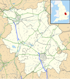
Witchford /ˈwɪtʃfɔːrd/ is a village and civil parish about 2.5 miles (4 km) west of Ely, Cambridgeshire, England. The 2011 Census recorded the parish's population as 2,385.[1]
| Witchford | |
|---|---|
 St Andrew's parish church | |
Location within Cambridgeshire | |
| Population | 2,385 (2011 Census) |
| OS grid reference | TL5078 |
| Civil parish |
|
| District |
|
| Shire county | |
| Region | |
| Country | England |
| Sovereign state | United Kingdom |
| Post town | Ely |
| Postcode district | CB6 |
| Dialling code | 01353 |
| Police | Cambridgeshire |
| Fire | Cambridgeshire |
| Ambulance | East of England |
| UK Parliament | |
| Website | Witchford Online |
History
editAnglo-Saxon cemetery
editWhen the site of RAF Witchford was being cleared a bulldozer driver found an Anglo-Saxon pagan cemetery on the site.[2][3] The bulldozer unearthed and crushed about 30 skeletons. Little archaeological work could be undertaken but some artefacts were recovered,[4] which T. C. Lethbridge stated to be consistent with the period AD 450–650.[5]
More recent survey work has found Iron Age and Roman domestic and other remains. An Anglo-Saxon cemetery was not found at that time, leading to the conclusion that this was not the site of the lost village of Cratendune.[6]
Hundreds
editTwo hundreds of the Isle of Ely, North Witchford and South Witchford, took their name from the place and had their meeting-place at Witchford.
RAF Witchford
editRAF Witchford was a RAF Bomber Command station that was built in 1942 and closed and dismantled in 1946. From July to September 1943 it was the base of No. 196 Squadron RAF which operated Vickers Wellington medium bombers. From November 1943 until April 1945 No. 115 Squadron RAF was based at Witchford operating Avro Lancaster heavy bombers.
After the Second World War it was proposed to convert the airfield to a missile base. Rumours said it was to become a Blue Streak base. Hence some older residents refer to the site (now an industrial park) as "The Rocket Base".[citation needed]
The village has an RAF Witchford Museum.[7]
Church and chapel
editParish church
editThe oldest part of the Church of England parish church of St Andrew are its 13th-century font and west tower. The nave and chancel were rebuilt in 1376. Two 14th- or 15th-century niches flank the chancel arch. The timber frame of the nave roof is 17th-century.[8] The west tower has a ring of three bells, all cast by Christopher Graye of Haddenham in 1671.[9] St Andrew's is a Grade II* listed building.[8]
Baptist chapel
editWitchford has a Baptist chapel.
Amenities
editSchool
editWitchford Village College is a secondary school that serves all the surrounding parishes, including Haddenham, Little Thetford, Mepal, Stretham, Sutton, Wilburton and Witcham.[10]
Pub
editWitchford has a pub, the Village Inn.[11]
Half Marathon
editThe parish hosts the Grunty Fen Half Marathon road race, which has been held here annually since 1991.[12] The race begins and ends at Witchford Village College and involves two laps into the nearby Grunty Fen.
References
edit- ^ "Area: Witchford (Parish): Key Figures for 2011 Census: Key Statistics". Neighbourhood Statistics. Office for National Statistics. 2013. Retrieved 2 February 2013.
- ^ "Inhumation Cemetery". Cambridgeshire Historic Environment Record. Heritage Gateway. Retrieved 13 October 2017.
- ^ "Early Medieval Inhumation Cemetery 450 – 650". PastScape. Heritage Gateway. Retrieved 13 October 2017.
- ^ Murray & Garrood 1955, p. 71.
- ^ Fowler 1948, p. 71.
- ^ Cambridgeshire Archaeology Historic Environment Team Annual Report 2009, p. 7.
- ^ "RAF Witchford Museum images". Archived from the original on 27 April 2014.
- ^ a b Historic England. "Church of St Andrew (Grade II*) (1127000)". National Heritage List for England. Retrieved 13 October 2017.
- ^ Pickford, Chris (7 September 2010). "Witchford S Andrew". Dove's Guide for Church Bell Ringers. Central Council for Church Bell Ringers. Retrieved 13 October 2017.
- ^ "Catchment Area". Witchford Village College. Archived from the original on 6 March 2012.
- ^ The Village Inn
- ^ "Grunty Fen Half Marathon".
Bibliography
edit- "Lancaster Way, East Cambridgeshire" (PDF). Cambridgeshire Archaeology Historic Environment Team Annual Report. Cambridgeshire County Council: 7. 2009. Archived from the original (PDF) on 9 June 2011. Retrieved 19 August 2010.
- Fowler, Gordon (1948). "Cratendune: A problem of the Dark Ages" (PDF). Proceedings of the Cambridge Antiquarian Society. XLI. Bowes and Bowes for the Cambridge Antiquarian Society: 70–73. Retrieved 29 September 2010.
- Murray, Margaret; Garrood, JR (1955). "The Finds at Ely Fields Farm" (PDF). Proceedings of the Cambridge Antiquarian Society. XLVIII. Deighton Bell for the Cambridge Antiquarian Society: 48–49. Retrieved 29 September 2010.
- Pevsner, Nikolaus (1970) [1954]. Cambridgeshire. The Buildings of England (Second ed.). Harmondsworth: Penguin Books. pp. 504–505. ISBN 0-14-071010-8.
- Atkinson, TD; Hampson, Ethel; Long, ET; Meekings, CAF; Miller, Edward; Wells, HB; Woodgate, GMG (2002). "Witchford". In Pugh, RB (ed.). A History of the County of Cambridge and the Isle of Ely. Victoria County History. Vol. IV. London: Oxford University Press for the Institute of Historical Research. pp. 176–179.
