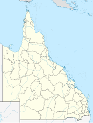
Yerra is a rural locality in the Fraser Coast Region, Queensland, Australia.[2] In the 2021 census, Yerra had a population of 110 people.[1]
| Yerra Queensland | |||||||||||||||
|---|---|---|---|---|---|---|---|---|---|---|---|---|---|---|---|
| Coordinates | 25°35′30″S 152°32′37″E / 25.5916°S 152.5436°E | ||||||||||||||
| Population | 110 (2021 census)[1] | ||||||||||||||
| • Density | 2.00/km2 (5.18/sq mi) | ||||||||||||||
| Postcode(s) | 4650 | ||||||||||||||
| Area | 55.0 km2 (21.2 sq mi) | ||||||||||||||
| Time zone | AEST (UTC+10:00) | ||||||||||||||
| Location |
| ||||||||||||||
| LGA(s) | Fraser Coast Region | ||||||||||||||
| State electorate(s) | Maryborough | ||||||||||||||
| Federal division(s) | Wide Bay | ||||||||||||||
| |||||||||||||||
Geography
editYerra railway station is an abandoned railway station on the now-closed Gayndah railway line (25°36′27″S 152°32′11″E / 25.6075°S 152.5364°E).[3]
History
editYerra State School opened on 11 November 1912.[4] The school was on a 2-acre (0.81 ha) site donated by W. Day within a "few hundred yards" of the railway station.[5] The first teacher was Miss McWatters.[6] It closed on 13 December 1974.[7]
Myrtle Creek State School opened in 1918. The school building from Thinoomba was relocated to Myrtle Creek, about 3.5 miles (5.6 km) from Yerra. Miss Gibson was the first teacher at the school and commenced her duties on 11 May 1918.[8] The school closed in 1929.[7] In August 1932, the school building and playshed for offered for sale and removal,[9] but in December 1932, the school buildings were relocated to Pioneer's Rest State School in Pioneers Rest.[10]
Demographics
editIn the 2016 census, Yerra had a population of 102 people.[11]
In the 2021 census, Yerra had a population of 110 people.[1]
Education
editThere are no schools in Yerra. The nearest government primary school is Mungar State School in neighbouring Mungar to the east. The nearest government secondary school is Aldridge State High School in Maryborough to the north-east.[12]
References
edit- ^ a b c Australian Bureau of Statistics (28 June 2022). "Yerra (SAL)". 2021 Census QuickStats. Retrieved 28 February 2023.
- ^ "Yerra – locality in Fraser Coast Region (entry 46747)". Queensland Place Names. Queensland Government. Retrieved 10 June 2019.
- ^ "Railway stations and sidings - Queensland". Queensland Open Data. Queensland Government. 2 October 2020. Archived from the original on 5 October 2020. Retrieved 5 October 2020.
- ^ "Advertising". Maryborough Chronicle, Wide Bay And Burnett Advertiser. No. 12, 323. Queensland, Australia. 30 October 1912. p. 7. Retrieved 17 November 2024 – via National Library of Australia.
- ^ "Opening of Yerra School". The Brisbane Courier. No. 17, 102. Queensland, Australia. 4 November 1912. p. 6. Retrieved 17 November 2024 – via National Library of Australia.
- ^ "OPENING OF YERRA STATE SCHOOL". The Queenslander. Vol. 48TH YEAR, no. 2434. Queensland, Australia. 16 November 1912. p. 29. Retrieved 17 November 2024 – via National Library of Australia.
- ^ a b Queensland Family History Society (2010), Queensland schools past and present (Version 1.01 ed.), Queensland Family History Society, ISBN 978-1-921171-26-0
- ^ "YERRA". Maryborough Chronicle, Wide Bay And Burnett Advertiser. No. 14, 016. Queensland, Australia. 25 April 1918. p. 5. Retrieved 17 November 2024 – via National Library of Australia.
- ^ "Advertising". Maryborough Chronicle, Wide Bay And Burnett Advertiser. No. 19, 285. Queensland, Australia. 18 August 1932. p. 3. Retrieved 17 November 2024 – via National Library of Australia.
- ^ "TIARO". Maryborough Chronicle, Wide Bay And Burnett Advertiser. No. 19, 390. Queensland, Australia. 20 December 1932. p. 2. Retrieved 17 November 2024 – via National Library of Australia.
- ^ Australian Bureau of Statistics (27 June 2017). "Yerra (SSC)". 2016 Census QuickStats. Retrieved 20 October 2018.
- ^ "Layers: Locality; Schools and school catchments". Queensland Globe. Queensland Government. Archived from the original on 19 December 2017. Retrieved 17 November 2024.
Further reading
edit- Mathis, Pam J. (1988). A history of Mungar. P. J. Mathis. Includes Yerra & Pilerwa, Yengarie, Antigua, Pioneers Rest — via State Library of Queensland
