Gore Hill Freeway
Gore Hill Freeway | |
|---|---|
 | |
| Gore Hill Freeway in Lane Cove | |
 | |
| Coordinates |
|
| General information | |
| Type | Freeway |
| Length | 4 km (2.5 mi)[1] |
| Opened | 26 August 1992 |
| Route number(s) | |
| Former route number |
|
| Major junctions | |
| Western end | Longueville Road Artamon, Sydney |
for full list see Exits and Interchanges | |
| Eastern end | Naremburn, Sydney |
| Location(s) | |
| LGA(s) | City of Willoughby |
| Major suburbs / towns | Artarmon |
| Highway system | |
The Gore Hill Freeway is a 4-kilometre (2.5 mi) divided freeway located in Sydney, New South Wales that is part of the Sydney Orbital Network and the Highway 1. The primary function of the freeway is to provide an alternative high-grade route from Artarmon to Lane Cove and to reduce traffic demands on the Pacific Highway throughout Sydney's lower north shore, bypassing St Leonards and Gore Hill.[1]
History
This section needs expansion. You can help by adding to it. (September 2021) |
Construction of the freeway commenced in August 1988 as part of the Bicentennial Roads Program and opened to traffic on 26 August 1992.[2]
Route
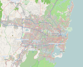
In the north-west, the freeway terminus is at the interchange with the Pacific Highway, the Lane Cove Tunnel and Longueville Road at Lane Cove. The south-eastern terminus is at the Warringah Freeway and Willoughby Road at Naremburn. On signs the Gore Hill Freeway is signed only as Freeway.
Forming part of the Sydney Orbital Network, the freeway provides access to most of the suburbs in Sydney; it is also a major route to the north, south, east and west of the metropolis.
Sound walls were pioneered as both art and architecture incorporating abstract road motifs in bas relief concrete and historical designs by Walter Burley Griffin. The language reinterprets local aboriginal rock engravings chipped into the ribbed retaining walls.[3]
Exits and interchanges
The entire road is in the City of Willoughby local government area.
| Location | km | mi | Destinations | Notes | |
|---|---|---|---|---|---|
| Artarmon | 0.0 | 0.0 | North-western terminus | ||
| 0.2 | 0.12 | Longueville Road – Lane Cove | Westbound exit and eastbound entrance | ||
| 0.5 | 0.31 | Reserve Road – Artarmon | No eastbound exit except from Longueville Road | ||
| 0.7 | 0.43 | Westbound exit and eastbound entrance | |||
| Naremburn | 3 | 1.9 | South-eastern terminus: continues as Warringah Freeway | ||
1.000 mi = 1.609 km; 1.000 km = 0.621 mi
| |||||
See also
References
- ^ a b "Gore Hill Freeway". Key build program. Roads & Maritime Services, Government of New South Wales. 2016. Retrieved 20 October 2016.
- ^ "Gore Hill Freeway: Construction information". Oz Roads. 2016. Retrieved 20 October 2016.
- ^ Goodwin, Richard (1992). "Gore Hill Freeway". Urban design. Richard Goodwin Pty Ltd. Retrieved 20 October 2016.
External links
- Merton, Mark. "Gore Hill Freeway" (aerial images). Sydney Images.
