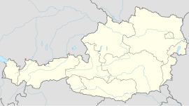
Grünau im Almtal
Appearance
Grünau im Almtal | |
|---|---|
 | |
| Coordinates: 47°51′10″N 13°57′20″E / 47.85278°N 13.95556°E | |
| Country | Austria |
| State | Upper Austria |
| District | Gmunden |
| Area | |
• Total | 229.97 km2 (88.79 sq mi) |
| Elevation | 528 m (1,732 ft) |
| Population (2018-01-01)[2] | |
• Total | 2,064 |
| • Density | 9.0/km2 (23/sq mi) |
| Time zone | UTC+1 (CET) |
| • Summer (DST) | UTC+2 (CEST) |
| Postal code | 4645 |
| Area code | 07616 |
| Vehicle registration | GM |
| Website | www.gruenau.at |
Grünau im Almtal is a village in the Austrian state of Upper Austria.
Geography
[edit]Grünau is surrounded by mountains with a central river (Alm) that runs throughout the valley.
Sport
[edit]Grünau also has a passionate connection with their local football team, UFC Drack Bau Grünau. Home games are played at the local football arena, Sportplatz Union Grünau.
Other
[edit]Near the Almsee lake, there is Hubertihaus, a hunting lodge of the House of Hanover.
References
[edit]- ^ "Dauersiedlungsraum der Gemeinden Politischen Bezirke und Bundesländer - Gebietsstand 1.1.2018". Statistics Austria. Retrieved 10 March 2019.
- ^ "Einwohnerzahl 1.1.2018 nach Gemeinden mit Status, Gebietsstand 1.1.2018". Statistics Austria. Retrieved 9 March 2019.

