Rogoza
Appearance
Rogoza | |
|---|---|
| Coordinates: 46°29′59.97″N 15°41′2.92″E / 46.4999917°N 15.6841444°E | |
| Country | |
| Traditional region | Styria |
| Statistical region | Drava |
| Municipality | Hoče-Slivnica |
| Area | |
• Total | 4.73 km2 (1.83 sq mi) |
| Elevation | 266.4 m (874.0 ft) |
| Population (2002) | |
• Total | 1,187 |
| [1] | |
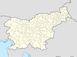
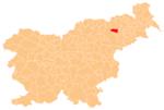
Rogoza (pronounced [ɾɔˈɡoːza]) is a settlement in the Municipality of Hoče-Slivnica in northeastern Slovenia. It lies on the flatlands on the right bank of the Drava River between Spodnje Hoče and Miklavž na Dravskem Polju. The area is part of the traditional region of Styria. The municipality is now included in the Drava Statistical Region.[2]
After the Second World War, a Yugoslav labor camp for political prisoners operated in Rogoza.[3]
In 1998 and 1999, during the preparations for the construction of the Maribor eastern bypass section of the A1 Motorway that runs just west of the settlement, Bronze Age and Iron Age sites were identified near the settlement.[4]
References
[edit]- ^ Statistical Office of the Republic of Slovenia
- ^ Hoče–Slivnica municipal site
- ^ Mrvič, Irena. 1999. "Taborišče." Enciklopedija Slovenije, vol. 13 (Š–T), pp. 177–179. Ljubljana: Mladinska knjiga, p. 179.
- ^ Slovenian Ministry of Culture register of national heritage reference number ešd 15509 & 15522
External links
[edit] Media related to Rogoza at Wikimedia Commons
- Rogoza on Geopedia

