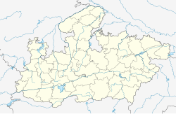
Surpala
Appearance
Surpala | |
|---|---|
Village | |
| Coordinates: 21°54′22″N 75°43′34″E / 21.906°N 75.726°E | |
| Country | |
| State | Madhya Pradesh |
| District | Khargone |
| Government | |
| • Sarpanch | Radhu Bhai |
| Population (2001) | |
• Total | 1,200 |
| Languages | |
| • Official | Hindi |
| Time zone | UTC+5:30 (IST) |
| Telephone code | 07280 |
Surpala is a village situated in Khargone District of Madhya Pradesh, India. Surpala belongs to Barwaha Tehsil and Khargone District. It is located in the area known as West Nimar.
Economy
[edit]Economically this village is dependent on agriculture. It is known for production of cotton, papaya, wheat, soybean and chili. The main language spoken in the area is Nimari (a regional language, generally spoken in rural parts of Khargone District) and official work is done in Hindi.
