Taber Airport: Difference between revisions
Appearance
Content deleted Content added
No edit summary |
m minor copy edits |
||
| (20 intermediate revisions by 14 users not shown) | |||
| Line 1: | Line 1: | ||
{{Infobox |
{{Infobox airport |
||
| name = Taber Airport |
| name = Taber Airport |
||
| IATA = |
| IATA = |
||
| ICAO = |
| ICAO = |
||
| |
| TC = CED5 |
||
| type = Public |
| type = Public |
||
| owner = |
| owner = |
||
| operator = |
| operator = [[Municipal District of Taber]] |
||
| city-served = |
| city-served = |
||
| location = [[Taber, Alberta]] |
| location = [[Municipal District of Taber]], near [[Taber, Alberta]] |
||
| timezone = [[Mountain Time Zone|MST]] |
|||
| utc = [[UTC−07:00]] |
|||
| summer = MDT |
|||
| utcs = [[UTC−06:00]] |
|||
| elevation-f = 2,648 |
| elevation-f = 2,648 |
||
| ⚫ | |||
| elevation-m = 807 |
|||
| pushpin_map = Canada Alberta |
|||
| ⚫ | |||
| |
| pushpin_label = CED5 |
||
| pushpin_map_caption = Location in Alberta |
|||
| website = |
|||
| r1-number = 05/23 |
| r1-number = 05/23 |
||
| r1-length-f = 3, |
| r1-length-f = 3,005 |
||
| r1- |
| r1-surface = Asphalt |
||
| r1-surface = [[Asphalt]] |
|||
| r2-number = 13/31 |
| r2-number = 13/31 |
||
| r2-length-f = |
| r2-length-f = 1,930 |
||
| r2-length-m = 610 |
|||
| r2-surface = Asphalt |
| r2-surface = Asphalt |
||
| stat-year = 2003 |
|||
| footnotes = Source: [[Canada Flight Supplement]]<ref name="CFS">{{CFS}}</ref> |
|||
| stat1-header = Aircraft movements |
|||
| stat1-data = 5,200 |
|||
| footnotes = Source: [[Canada Flight Supplement]]<ref name="CFS">{{CFS}}</ref><br>Movements from [[Aviation Alberta]]<ref name="move">[https://copanational.org/sites/copanational.org/wp-content/uploads/2016/12/AlbertaMay18.pdf Aircraft Movement Statistics: A Socio-Economic Impact Assessment of Select Alberta Airports]</ref> |
|||
}} |
}} |
||
'''Taber Airport''' |
'''Taber Airport''' {{Airport codes||||CED5}} is located {{convert|4|NM|lk=in}} north of [[Taber, Alberta|Taber]], [[Alberta]], [[Canada]]. |
||
==References== |
==References== |
||
<references/> |
<references/> |
||
==External links== |
|||
*[https://copanational.org/en/places-to-fly/ Place to Fly] on [[Canadian Owners and Pilots Association|COPA's]] ''Places to Fly'' airport directory |
|||
{{Portal bar|Canada|Aviation}} |
|||
{{List of airports in Canada}} |
{{List of airports in Canada}} |
||
{{authority control}} |
|||
[[Category: |
[[Category:Registered aerodromes in Alberta]] |
||
| ⚫ | |||
[[Category:Municipal District of Taber]] |
|||
{{Alberta-airport-stub}} |
{{Alberta-airport-stub}} |
||
[[id:Bandar Udara Taber]] |
|||
| ⚫ | |||
Latest revision as of 19:25, 17 August 2021
Taber Airport | |||||||||||||||
|---|---|---|---|---|---|---|---|---|---|---|---|---|---|---|---|
| Summary | |||||||||||||||
| Airport type | Public | ||||||||||||||
| Operator | Municipal District of Taber | ||||||||||||||
| Location | Municipal District of Taber, near Taber, Alberta | ||||||||||||||
| Time zone | MST (UTC−07:00) | ||||||||||||||
| • Summer (DST) | MDT (UTC−06:00) | ||||||||||||||
| Elevation AMSL | 2,648 ft / 807 m | ||||||||||||||
| Coordinates | 49°49′35″N 112°11′05″W / 49.82639°N 112.18472°W | ||||||||||||||
| Map | |||||||||||||||
 | |||||||||||||||
| Runways | |||||||||||||||
| |||||||||||||||
| Statistics (2003) | |||||||||||||||
| |||||||||||||||
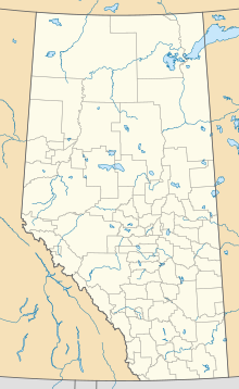
Taber Airport (TC LID: CED5) is located 4 nautical miles (7.4 km; 4.6 mi) north of Taber, Alberta, Canada.
References
[edit]- ^ Canada Flight Supplement. Effective 0901Z 16 July 2020 to 0901Z 10 September 2020.
- ^ Aircraft Movement Statistics: A Socio-Economic Impact Assessment of Select Alberta Airports
External links
[edit]- Place to Fly on COPA's Places to Fly airport directory
