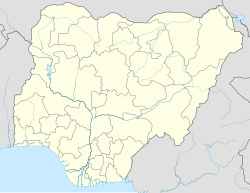
Yola North
Appearance
Yola North | |
|---|---|
 Map of Adamawa State highlighting Yola North | |
| Coordinates: 9°12′00″N 12°29′00″E / 9.2°N 12.4833°E | |
| Country | |
| State | Adamawa State |
| Capital | Yola |
| Area | |
• Total | 25.98 sq mi (67.30 km2) |
| Population (2022)[1] | |
• Total | 307,900 |
| • Density | 12,000/sq mi (4,600/km2) |
| Time zone | UTC+1 (WAT) |
 | |
Yola North is a Local Government Area of Adamawa State, Nigeria. It includes Jimeta. It is a suburb of Yola (Yola South).
Yola is the administrative capital of Adamawa State in Nigeria's northeastern region.[2]
Climate/Geography
[edit]Yola North LGA experiences two distinct seasons—the dry and the rainy—with an average temperature of 33 degrees Celsius. The well-known Mandara Mountains range is located in the LGA, and the average wind speed in the region is 10 km/h.[3][4]
References
[edit]- ^ "Yola North (Local Government Area, Nigeria) - Population Statistics, Charts, Map and Location". www.citypopulation.de. Retrieved 2024-02-05.
- ^ International Journal of Applied Science and Engineering Research. Integrated Publishing Association.
- ^ "Yola North Local Government Area". www.manpower.com.ng. Retrieved 2024-08-09.
- ^ "Yola North, Nigeria Weather Conditions | Weather Underground". www.wunderground.com. Retrieved 2024-08-09.

