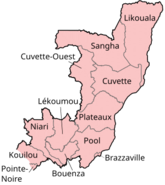
Bétou District
Appearance
Bétou | |
|---|---|
 | |
| Country | |
| Region | Likouala Department |
| Area | |
• Total | 1,390 sq mi (3,599 km2) |
| Population (2023 census)[1] | |
• Total | 126,956 |
| • Density | 91/sq mi (35/km2) |
| Time zone | UTC+1 (GMT +1) |
Bétou is a district in the Likouala Department of Republic of the Congo.[2][3][4][5]
References
[edit]- ^ "Congo (Rep.): Administrative Division". www.citypopulation.de. Retrieved 2024-02-03.
- ^ "Districts of the Republic of Congo (Congo Brazzaville)". statoids. Retrieved 28 January 2019.
- ^ "Annuaire Statistique du Congo 2004" (PDF) (in French). Centre National de la Statistique et des Études Économiques (CNSEE). 2006. Archived from the original (PDF) on 13 November 2009. Retrieved 26 May 2012.
- ^ "Annuaire Statistique du Congo 2007" (PDF) (in French). Centre National de la Statistique et des Études Économiques (CNSEE). 2009. Archived from the original (PDF) on 7 July 2012. Retrieved 26 May 2012.
- ^ "Annuaire Statistique du Congo 2009" (PDF) (in French). Centre National de la Statistique et des Études Économiques (CNSEE). 2011. Archived from the original (PDF) on 2 February 2013. Retrieved 26 May 2012.
