Backbone Fire
| Backbone Fire | |
|---|---|
 Map of the Backbone Fire on June 30 | |
| Date(s) | June 16, 2021 – July 19, 2021 |
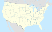
| Location | Payson, Arizona |
| Coordinates | 34°20′38″N 111°40′37″W / 34.344°N 111.677°W |
| Statistics | |
| Burned area | 40,855 acres (16,533 ha) |
| Ignition | |
| Cause | Lightning |
| Map | |
The Backbone Fire was a wildfire that started near Payson, Arizona on June 16, 2021. The fire burned 40,855 acres (16,533 ha) was fully contained on July 19, 2021.[1][2]
Events
[edit]The Backbone Fire was first reported on June 16, 2021, at 11:30 pm MST.[1] The cause of the fire is believed to be due to lightning.[1] On July 19, 2021, the Backbone Fire reached 100% containment.[1][2]
Impact
[edit]Closures and evacuations
[edit]Fossil Creek Recreation Area was closed on June 17, 2021, due to wildfire danger.[3] On June 19, 2021, the USDA Forest Service Coconino National Forest issued an Emergency Area Closure of areas around the Backbone Fire on the Coconino and Tonto National Forests.[3] The Coconino National Forest was fully closed on June 23, 2021, due to fire danger, dry conditions, persistent wildfire activity, and limited availability of firefighting resources.[3] The Coconino National Forest was reopened on July 6, 2021.
References
[edit]- ^ a b c d "Backbone Fire Information - InciWeb the Incident Information System". inciweb.nwcg.gov. Retrieved 2021-06-21.
- ^ a b "National Fire News". National Interagency Fire Center.
- ^ a b c "Backbone Fire Closures - InciWeb the Incident Information System". InciWeb - Incident Information System.

