Central District (Marivan County)
Appearance
Central District (Marivan County)
Persian: بخش مرکزی شهرستان مریوان | |
|---|---|
| Coordinates: 35°29′00″N 46°15′46″E / 35.48333°N 46.26278°E[1] | |
| Country | Iran |
| Province | Kurdistan |
| County | Marivan |
| Capital | Marivan |
| Population (2016)[2] | |
• Total | 176,450 |
| Time zone | UTC+3:30 (IRST) |
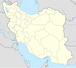
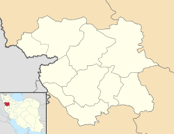
The Central District of Marivan County (Persian: بخش مرکزی شهرستان مریوان) is in Kurdistan province, Iran. Its capital is the city of Marivan.[3]
History
[edit]After the 2006 National Census, the village of Kani Dinar was elevated to the status of a city.[4]
Demographics
[edit]Population
[edit]At the time of the 2006 census, the district's population was 128,445 in 30,732 households.[5] The following census in 2011 counted 148,324 people in 39,482 households.[6] The 2016 census measured the population of the district as 176,450 inhabitants in 50,506 households.[2]
Administrative divisions
[edit]| Administrative Divisions | 2006[5] | 2011[6] | 2016[2] |
|---|---|---|---|
| Kumasi RD | 4,655 | 3,586 | 2,972 |
| Sarkal RD | 22,745 | 13,086 | 13,937 |
| Zarivar RD | 9,381 | 9,773 | 9,828 |
| Kani Dinar (city) | 11,415 | 13,059 | |
| Marivan (city) | 91,664 | 110,464 | 136,654 |
| Total | 128,445 | 148,324 | 176,450 |
| RD = Rural District | |||
See also
[edit]References
[edit]- ^ OpenStreetMap contributors (28 December 2024). "Central District (Marivan County)" (Map). OpenStreetMap (in Persian). Retrieved 28 December 2024.
- ^ a b c Census of the Islamic Republic of Iran, 1395 (2016): Kurdistan Province. amar.org.ir (Report) (in Persian). The Statistical Center of Iran. Archived from the original (Excel) on 8 May 2022. Retrieved 19 December 2022.
- ^ Habibi, Hassan (2 November 2017) [Approved 21 June 1369]. Approval of the organization and chain of citizenship of the elements and units of the national divisions of Kurdistan province, centered in the city of Sanandaj. rc.majlis.ir (Report) (in Persian). Ministry of the Interior, Defense Political Commission of the Government Board. Proposal 3233.1.5.53; Letter 907-93808; Notification 83352/T130K. Archived from the original on 23 October 2018. Retrieved 22 January 2024 – via Islamic Parliament Research Center of the Islamic Republic of Iran.
- ^ Davodi, Parviz (10 March 1388). The government's agreement with three changes in the national divisions of Razavi Khorasan and Kurdistan. Ministry of Interior (Report) (in Persian). Ministry of the Interior, Cabinet of Ministers. Archived from the original on 4 March 2016. Retrieved 17 August 2023.
- ^ a b Census of the Islamic Republic of Iran, 1385 (2006): Kurdistan Province. amar.org.ir (Report) (in Persian). The Statistical Center of Iran. Archived from the original (Excel) on 20 September 2011. Retrieved 25 September 2022.
- ^ a b Census of the Islamic Republic of Iran, 1390 (2011): Kurdistan Province. irandataportal.syr.edu (Report) (in Persian). The Statistical Center of Iran. Archived from the original (Excel) on 19 January 2023. Retrieved 19 December 2022 – via Iran Data Portal, Syracuse University.


