Choiceland
Appearance
Choiceland | |
|---|---|
Town | |
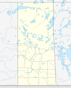
Location of Choiceland in Saskatchewan | |
| Coordinates: 53°29′24″N 104°29′10″W / 53.49°N 104.486°W | |
| Country | Canada |
| Province | Saskatchewan |
| Rural Municipality | No. 488 |
| Post office established | 1927 |
| Government | |
| • Mayor | Rob Mardell |
| • Administrator | Holly Toews |
| Area | |
| • Land | 1.12 km2 (0.43 sq mi) |
| Population (2011) | |
• Total | 359 |
| • Density | 321.1/km2 (832/sq mi) |
| Time zone | CST |
| Postal code | S0J 0M0 |
| Area code | 306 |
| Website | www |
| [1][2][3] | |
Choiceland is a town in Saskatchewan, Canada. Choiceland is located an hour or so from Prince Albert, a larger Saskatchewan city.
Choiceland is home to William Mason Public School, which offers schooling for grades kindergarten through 12.[citation needed]
The Torch River Railway is based in Choiceland.
Demographics
[edit]In the 2021 Census of Population conducted by Statistics Canada, Choiceland had a population of 342 living in 174 of its 204 total private dwellings, a change of -4.7% from its 2016 population of 359. With a land area of 1.06 km2 (0.41 sq mi), it had a population density of 322.6/km2 (835.6/sq mi) in 2021.[4]
Canada census – Choiceland community profile
| 2021 | 2016 | 2011 | |
|---|---|---|---|
| Population | 342 (-4.7% from 2016) | 359 (-5.8% from 2011) | 381 (10.1% from 2006) |
| Land area | 1.06 km2 (0.41 sq mi) | 1.12 km2 (0.43 sq mi) | 1.12 km2 (0.43 sq mi) |
| Population density | 323.9/km2 (839/sq mi) | 321.1/km2 (832/sq mi) | 340.8/km2 (883/sq mi) |
| Median age | 47.6 (M: 49.2, F: 47.2) | 44.4 (M: 41.1, F: 51.0) | 46.6 (M: 44.2, F: 47.2) |
| Private dwellings | 204 (total) 174 (occupied) | 204 (total) | 210 (total) |
| Median household income | $52,800 | $47,616 |
Climate
[edit]| Climate data for Choiceland | |||||||||||||
|---|---|---|---|---|---|---|---|---|---|---|---|---|---|
| Month | Jan | Feb | Mar | Apr | May | Jun | Jul | Aug | Sep | Oct | Nov | Dec | Year |
| Record high °C (°F) | 9 (48) |
9.5 (49.1) |
16.5 (61.7) |
31.7 (89.1) |
35 (95) |
37 (99) |
36.1 (97.0) |
36.1 (97.0) |
35 (95) |
28.3 (82.9) |
20.6 (69.1) |
8.3 (46.9) |
37 (99) |
| Mean daily maximum °C (°F) | −13.6 (7.5) |
−9.4 (15.1) |
−1.5 (29.3) |
8.6 (47.5) |
18.2 (64.8) |
22 (72) |
24.1 (75.4) |
22.8 (73.0) |
16.4 (61.5) |
8.7 (47.7) |
−4.2 (24.4) |
−11.9 (10.6) |
6.7 (44.1) |
| Daily mean °C (°F) | −18.7 (−1.7) |
−14.9 (5.2) |
−7.4 (18.7) |
2.7 (36.9) |
11.2 (52.2) |
15.2 (59.4) |
17.4 (63.3) |
16 (61) |
10 (50) |
3.4 (38.1) |
−8.4 (16.9) |
−16.6 (2.1) |
0.8 (33.4) |
| Mean daily minimum °C (°F) | −23.7 (−10.7) |
−20.5 (−4.9) |
−13.3 (8.1) |
−3.3 (26.1) |
4.2 (39.6) |
8.3 (46.9) |
10.7 (51.3) |
9.2 (48.6) |
3.6 (38.5) |
−2 (28) |
−12.6 (9.3) |
−21.4 (−6.5) |
−5.1 (22.8) |
| Record low °C (°F) | −47.8 (−54.0) |
−45 (−49) |
−39.4 (−38.9) |
−33.9 (−29.0) |
−11.1 (12.0) |
−3.3 (26.1) |
0 (32) |
−3 (27) |
−11.1 (12.0) |
−25 (−13) |
−37.8 (−36.0) |
−43 (−45) |
−47.8 (−54.0) |
| Average precipitation mm (inches) | 19.7 (0.78) |
18.6 (0.73) |
20.1 (0.79) |
26.7 (1.05) |
46.9 (1.85) |
82.3 (3.24) |
78.2 (3.08) |
65.2 (2.57) |
52 (2.0) |
28.1 (1.11) |
22.9 (0.90) |
23.2 (0.91) |
483.7 (19.04) |
| Source: Environment Canada[10] | |||||||||||||
See also
[edit]References
[edit]- ^ "2011 Community Profiles". Statistics Canada. Government of Canada. Archived from the original on December 26, 2018. Retrieved March 20, 2014.
- ^ National Archives, Archivia Net. "Post Offices and Postmasters". Archived from the original on October 6, 2006. Retrieved March 20, 2014.
- ^ Government of Saskatchewan, MRD Home. "Municipal Directory System". Archived from the original on January 15, 2016. Retrieved March 20, 2014.
- ^ "Population and dwelling counts: Canada, provinces and territories, census divisions and census subdivisions (municipalities), Saskatchewan". Statistics Canada. February 9, 2022. Retrieved April 1, 2022.
- ^ "2021 Community Profiles". 2021 Canadian census. Statistics Canada. February 4, 2022. Retrieved October 19, 2023.
- ^ "2016 Community Profiles". 2016 Canadian census. Statistics Canada. August 12, 2021. Retrieved November 29, 2017.
- ^ "2011 Community Profiles". 2011 Canadian census. Statistics Canada. March 21, 2019. Retrieved July 7, 2012.
- ^ "2006 Community Profiles". 2006 Canadian census. Statistics Canada. August 20, 2019.
- ^ "2001 Community Profiles". 2001 Canadian census. Statistics Canada. July 18, 2021.
- ^ Environment Canada Canadian Climate Normals 1971–2000, accessed 24 July 2010

