Dieulouard
Appearance
Dieulouard | |
|---|---|
The church in Dieulouard | |
| Coordinates: 48°50′26″N 6°04′14″E / 48.8406°N 6.0706°E | |
| Country | France |
| Region | Grand Est |
| Department | Meurthe-et-Moselle |
| Arrondissement | Nancy |
| Canton | Entre Seille et Meurthe |
| Government | |
| • Mayor (2020–2026) | Henri Poirson[1] |
| Area 1 | 17.69 km2 (6.83 sq mi) |
| Population (2021)[2] | 4,658 |
| • Density | 260/km2 (680/sq mi) |
| Time zone | UTC+01:00 (CET) |
| • Summer (DST) | UTC+02:00 (CEST) |
| INSEE/Postal code | 54157 /54380 |
| Elevation | 177–307 m (581–1,007 ft) (avg. 185 m or 607 ft) |
| 1 French Land Register data, which excludes lakes, ponds, glaciers > 1 km2 (0.386 sq mi or 247 acres) and river estuaries. | |
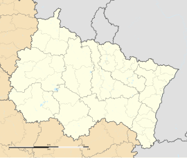
Dieulouard (French pronunciation: [djølwaʁ]; formerly Dieulwart) is a commune in the Meurthe-et-Moselle department in north-eastern France. Dieulouard is located between Pont-à-Mousson and Nancy, on the left bank of the Moselle. It is the location of the Gallo-Roman city of Scarpone.
In August 1608 a small group of exiled English Benedictines were given a deserted collegiate church in the town. The church was dedicated to St Laurence and so the monks adopted him as the patron of their community. During the French Revolution the community was forced to flee France. In 1802 the monks settled at Ampleforth Abbey in North Yorkshire.
Population
[edit]| Year | Pop. | ±% p.a. |
|---|---|---|
| 1968 | 5,332 | — |
| 1975 | 5,372 | +0.11% |
| 1982 | 5,212 | −0.43% |
| 1990 | 4,903 | −0.76% |
| 1999 | 4,767 | −0.31% |
| 2007 | 4,616 | −0.40% |
| 2012 | 4,545 | −0.31% |
| 2017 | 4,763 | +0.94% |
| Source: INSEE[3] | ||
See also
[edit]References
[edit]- ^ "Répertoire national des élus: les maires". data.gouv.fr, Plateforme ouverte des données publiques françaises (in French). 2 December 2020.
- ^ "Populations légales 2021" (in French). The National Institute of Statistics and Economic Studies. 28 December 2023.
- ^ Population en historique depuis 1968, INSEE
External links
[edit]Wikimedia Commons has media related to Dieulouard.


