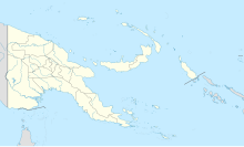
Gasmata Airport
Appearance
Gasmata Airport | |||||||||||
|---|---|---|---|---|---|---|---|---|---|---|---|
| Summary | |||||||||||
| Location | Gasmata, Papua New Guinea | ||||||||||
| Elevation AMSL | 10 ft / 3 m | ||||||||||
| Coordinates | 6°16′30″S 150°20′0″E / 6.27500°S 150.33333°E | ||||||||||
| Map | |||||||||||
 | |||||||||||
| Runways | |||||||||||
| |||||||||||
Source: PNG Airstrip Guide[1] | |||||||||||
Gasmata Airport (IATA: GMI) is an airfield in Gasmata in the West New Britain Province of Papua New Guinea.[1]
Facilities
[edit]The airfield is at an elevation of 10 feet (3 m) above mean sea level and has a 820-metre (2,690 ft) runway designated 09/27.[1]
Airlines and destinations
[edit]Tropicair
References
[edit]- ^ a b c PNG Airstrip Guide. August 2005.
External links
[edit]
