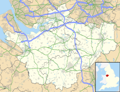
Hoole Village
| Hoole Village | |
|---|---|
 Mayfield House, Hoole Village | |
Location within Cheshire | |
| Population | 319 (2011 census) |
| OS grid reference | SJ432681 |
| Civil parish | |
| Unitary authority | |
| Ceremonial county | |
| Region | |
| Country | England |
| Sovereign state | United Kingdom |
| Post town | CHESTER |
| Postcode district | CH2 |
| Dialling code | 01244 |
| Police | Cheshire |
| Fire | Cheshire |
| Ambulance | North West |
| UK Parliament | |
Hoole Village is a former civil parish, now in the parishes of Mickle Trafford and District and Guilden Sutton, in the unitary authority of Cheshire West and Chester and the ceremonial county of Cheshire, England, near Chester. The parish contained the southern end of the M53 motorway where it becomes the A55 road and is crossed by the A56 road. This junction is known as Hoole Island Junction.[1][2] Also in the village is Hoole Hall, which is now a hotel.[3]
In 2004 the population was 230,[4] rising to 319 at the time of the 2011 census.[5]
History
[edit]In September 1955 a prehistoric arrowhead and a worked flake were found in a garden in the parish. The arrowhead was dated to the period between the Early Bronze Age and the Early Iron Age (2350 BC to 701 BC). In 1995 aerial photography showed evidence of a Roman practice fort near to Hoole Hall. It is believed that the Roman road from Chester to Wilderspool (now part of Warrington) passed through the parish.[6]
The parish was formed on 31 December 1894[7] from the rural part of Hoole.[8] On 1 April 2015 the parish was abolished to form Mickle Trafford and District, part of it also went to Guilden Sutton.[9]
Landmarks and places of interest
[edit]Hoole Hall was built as a large house around 1720. The hall itself,[10] its attached conservatory built in the mid 19th century,[11] and the ha-ha wall and railings of the west terrace of the house[12] are Grade II listed buildings. The hall is now used as a hotel. Also listed Grade II is a restored pinfold in Oak Lane.[13]
See also
[edit]References
[edit]Notes
[edit]- ^ "Hoole Island Junction, Chester". Google Maps. Retrieved 31 August 2020.
- ^ "Hoole Island Junction". SABRE. Retrieved 31 August 2020.
- ^ "DoubleTree by Hilton Hotel & Spa Chester". Retrieved 31 August 2020.
- ^ Latham 2005, p. 9.
- ^ UK Census (2011). "Local Area Report – Hoole Village Parish (E04011114)". Nomis. Office for National Statistics. Retrieved 25 April 2021.
- ^ Latham 2005, pp. 10–14..
- ^ "Relationships and changes Hoole Village CP through time". A Vision of Britain through Time. Retrieved 22 September 2024.
- ^ "Chester Registration District". UKBMD. Retrieved 22 September 2024.
- ^ "Hoole Village". GENUKI. Retrieved 24 March 2018.
- ^ "Images of England: Hoole Hall". English Heritage. Retrieved 8 November 2007.
- ^ "Images of England: Conservatory attached to the south front of Hoole Hall". English Heritage. Retrieved 8 November 2007.
- ^ "Images of England: Ha-ha wall and railings of west terrace at Hoole Hall". English Heritage. Retrieved 8 November 2007.
- ^ "Images of England: Pinfold". English Heritage. Retrieved 8 November 2007.
Bibliography
[edit]- Latham, Frank A., ed. (2005), Mickle Trafford, The Local History Group, ISBN 0-9551470-1-8
