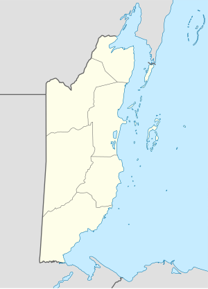
Hopkins, Belize
16°52′0″N 88°17′0″W / 16.86667°N 88.28333°W
Hopkins | |
|---|---|
 Hopkins Beach, Stann Creek, Belize | |
| Coordinates: 16°52′N 88°17′W / 16.867°N 88.283°W | |
| Country | |
| District | Stann Creek District |
| Time zone | UTC-6 (Central) |
| Climate | Af |
Hopkins Village is a coastal village in eastern Belize.
Demographics
[edit]At the time of the 2010 census, Hopkins had a population of 1,610. Of these, 70.2% were Garifuna, 9.9% Mixed, 6.0% Creole, 3.8% Mestizo, 3.2% Mopan Maya, 2.2% Caucasian, 1.4% Asian, 1.3% Ketchi Maya, 0.5% African, 0.3% East Indian, 0.1% Mennonite and 0.9% others.[1]
Culture
[edit]Hopkins is a Garifuna village on the coast of the Stann Creek District in Belize. Hopkins is considered by some Belizeans to be the cultural center of the Garifuna population in Belize. The town hosts its own community holiday, Hopkins Day, and welcomes people for the cultural celebration of Garifuna Settlement Day as well, they do this with drum ceremonies that can last till early hours in the morning.
Geography
[edit]The village is separated into two parts; the Northside (Baila) and the Southside (False Sittee). Hopkins is surrounded by the Maya Mountains and the Cockscomb Range inland, and the Caribbean Sea on its shore. It is also very close to the Sittee River. The village was created in 1942 to replace the village of Newtown, which was devastated by a hurricane further up the coast.
Transportation
[edit]Transportation to Hopkins Village primarily involves road travel, with options including private shuttles, taxis, and rental cars. The village is about 2.5 hours from Philip S. W. Goldson International Airport (BZE) in Belize City. Regular bus services and shared shuttles also connect Hopkins to nearby towns and tourist destinations.
References
[edit]External links
[edit] Media related to Hopkins, Belize at Wikimedia Commons
 Hopkins (Belize) travel guide from Wikivoyage
- Official Hopkins Belize website
