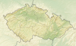
Káraný
Káraný | |
|---|---|
Chapel of Saint John of Nepomuk | |
| Coordinates: 50°10′29″N 14°44′13″E / 50.17472°N 14.73694°E | |
| Country | |
| Region | Central Bohemian |
| District | Prague-East |
| Founded | 1777 |
| Area | |
• Total | 8.94 km2 (3.45 sq mi) |
| Elevation | 173 m (568 ft) |
| Population (2024-01-01)[1] | |
• Total | 823 |
| • Density | 92/km2 (240/sq mi) |
| Time zone | UTC+1 (CET) |
| • Summer (DST) | UTC+2 (CEST) |
| Postal code | 250 75 |
| Website | www |
Káraný is a municipality and village in Prague-East District in the Central Bohemian Region of the Czech Republic. It has about 800 inhabitants.
Etymology
[edit]Káraný was originally name of a forest in which game hunting and tree cutting were "severely punished" (in old Czech káráno).[2]
Geography
[edit]Káraný is located about 11 kilometres (7 mi) northeast of Prague. It lies in the Central Elbe Table. The municipality is situated at the confluence of the Elbe and Jizera rivers.
History
[edit]Káraný was founded in 1777.[3]
Demographics
[edit]
|
|
| ||||||||||||||||||||||||||||||||||||||||||||||||||||||
| Source: Censuses[4][5] | ||||||||||||||||||||||||||||||||||||||||||||||||||||||||
Transport
[edit]The Prague–Kolín railway line runs through the municipal territory, but there is no train station. The municipality is served by the station in neighbouring Čelákovice.
Economy
[edit]Thanks to its location, Káraný is known as a recreation area. A significant majority of the houses in the village are cottages of residents of Prague and other larger towns nearby.[6]
Since 1914, Káraný has supplied Prague with drinking water. Its water treatment facility on right bank of the Elbe is one of three major sources of drinking water for Prague.[7]
In 2010–2012, a small hydroelectric power plant was built.[8]
Sights
[edit]The most valuable building is the former inn. It is a pseudo-Baroque house with Art Nouveau elements from the beginning of the 20th century. Today it is in a desolate state and unused.[9]
A landmark is the Chapel of Saint John of Nepomuk in the centre of the village.
References
[edit]- ^ "Population of Municipalities – 1 January 2024". Czech Statistical Office. 2024-05-17.
- ^ Profous, Antonín (1949). Místní jména v Čechách II: CH–L (in Czech). p. 204.
- ^ "Založení osady Káraný" (in Czech). Obec Káraný. Retrieved 2021-06-21.
- ^ "Historický lexikon obcí České republiky 1869–2011" (in Czech). Czech Statistical Office. 2015-12-21.
- ^ "Population Census 2021: Population by sex". Public Database. Czech Statistical Office. 2021-03-27.
- ^ "Stručná historie" (in Czech). Obec Káraný. Retrieved 2021-06-21.
- ^ "Vznik vodárny" (in Czech). Obec Káraný. Retrieved 2021-06-21.
- ^ "Vodní elektrárna" (in Czech). Obec Káraný. Retrieved 2021-06-21.
- ^ "Hostinec U vodárny" (in Czech). National Heritage Institute. Retrieved 2024-01-30.
External links
[edit]


