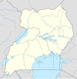
Kakiri
Kakiri | |
|---|---|
 Kakiri research site | |
| Coordinates: 00°25′12″N 32°23′24″E / 0.42000°N 32.39000°E | |
| Country | |
| Region | Central Region of Uganda |
| District | Wakiso District |
| Elevation | 3,870 ft (1,180 m) |
| Population (2020 Estimate) | |
• Total | 28,100[1] |
Kakiri is a town located in Wakiso District in the Central Region of Uganda.[2] Kakiri is the site of the headquarters of the first division of the Uganda People's Defence Force (UPDF).[3] It is also the hometown of Gilbert Bukenya, who represents the town and the surrounding constituency of Busiro North in the parliament of Uganda and is a former vice president of Uganda.[4]
History
[edit]Kakiri was affected by the Ugandan Bush War. On 5 April 1981, the town was the site of a Popular Resistance Army raid targeting a local Uganda National Liberation Army (UNLA) camp.[5] In April 1982, UNLA soldiers murdered and buried 55 civilians at Kakiri, accusing them of superstitious activities.[6] One month later, another 20 people were murdered by UNLA troops near the town; the soldiers dumped their corpses along the Kampala–Hoima Road.[7] In late 1982, a National Resistance Army contingent under Salim Saleh raided Kakiri.[8]
Location
[edit]Kakiri is approximately 29 kilometres (18 mi), by road, northwest of Kampala, the capital of Uganda. The town is located on the Kampala–Hoima Road, connecting Kampala to Uganda's oil capital of Hoima".[9] The coordinates of Kakiri are 0°25'12.0"N, 32°23'24.0"E (Latitude:0.4200; Longitude:32.3900).[10]
Population
[edit]In 2002, the national population census put the population of the town at about 4,200. In 2010, the Uganda Bureau of Statistics (UBOS) estimated the population at 5,800. In 2011, UBOS estimated the population at 6,000 inhabitants.[11] In 2014, the national population census put the population at 19,449.[12]
In 2015, UBOS estimated the population of Kakiri at 20,300. In 2020, the population agency estimated the mid-year population of the town at 28,100. Of these, 14,400 (51.2 percent) were females and 13,700 (48.8 percent were females). UBOS calculated that the population growth rate between 2015 and 2020, averaged 6.7 percent annually.[1]
| Year | Pop. | ±% |
|---|---|---|
| 2002 | 4,200 | — |
| 2010 | 5,800 | +38.1% |
| 2011 | 6,000 | +3.4% |
| 2014 | 19,449 | +224.1% |
| 2015 | 20,300 | +4.4% |
| 2020 | 28,100 | +38.4% |
| source:[1][11][12] | ||
Points of interest
[edit]The following additional points of interest lie in Kakiri or near the town limits:[10] (a) The offices of Kakiri Town Council (b) a branch of PostBank Uganda, a government-owned financial institution (c) Kakiri Central Market and (d) Kampala–Hoima Road passes through the middle of town in a northwest/southeast direction.[10]
The headquarters of the First División of the UPDF are located about 3.5 kilometres (2 mi) southeast of downtown Kakiri.[13]
Photos
[edit]See also
[edit]References
[edit]- ^ a b c Citypopulation.de (14 June 2020). "The population development of Kakiri as well as related information and services" (Citypopulation.de Quoting Uganda Bureau of Statistics). Citypopulation.de. Retrieved 12 June 2021.
- ^ Tourist Link (12 June 2021). "Overview of Kakiri, Wakiso District, Uganda". Nagpur, Maharashtra, India: Touristlink.com. Retrieved 12 June 2021.
- ^ Kato, Joshua (25 May 2013). "Uganda's Longest Serving Army Commander". New Vision. Retrieved 12 July 2014.
- ^ Hennty Mukasa, and Jeff Lule (2 December 2011). "Bukenya Retains Busiro North Seat". New Vision. Retrieved 12 July 2014.
- ^ Cooper & Fontanellaz 2015, p. 42.
- ^ Kasozi 1994, p. 243.
- ^ Kasozi 1994, pp. 146, 243.
- ^ Kainerugaba 2010, pp. 81, 88.
- ^ "Road Distance Between Kampala, Uganda And Kakiri, Uganda". Retrieved 12 June 2021.
- ^ a b c "Location of Kakiri at Google Maps" (Map). Google Maps. Retrieved 12 July 2015.
- ^ a b Uganda Bureau of Statistics (2012). "Estimated Population of Kakiri In 2002, 2010 & 2011" (PDF). Kampala: Uganda Bureau of Statistics. Archived from the original (Archived from the original on 7 July 2014) on 2014-07-07. Retrieved 12 June 2021.
- ^ a b Uganda Bureau of Statistics (27 August 2014). "The Population of The Regions of the Republic of Uganda And All Cities And Towns of More Than 15,000 Inhabitants". Citypopulation.de Quoting Uganda Bureau of Statistics. Retrieved 26 February 2015.
- ^ "Road Distance Between Downtown Kakiri And Kakiri Military Barracks" (Map). Google Maps. Retrieved 12 June 2021.
Works cited
[edit]- Cooper, Tom; Fontanellaz, Adrien (2015). Wars and Insurgencies of Uganda 1971–1994. Solihull: Helion & Company Limited. ISBN 978-1-910294-55-0.
- Kainerugaba, Muhoozi (2010). Battles of the Ugandan Resistance: A Tradition of Maneuver. Kampala: Fountain Publishers. ISBN 978-9970-25-032-5.
- Kasozi, A. (1994). Social Origins of Violence in Uganda, 1964–1985. Montreal: McGill-Queen's Press. ISBN 978-0-7735-6487-9.
External links
[edit]

