Kaleerwe
Kaleerwe | |
|---|---|
| Coordinates: 00°21′36″N 32°34′12″E / 0.36000°N 32.57000°E | |
| Country | |
| Region | Central Uganda |
| District | Kampala Capital City Authority |
| Division | Kawempe Division |
| Time zone | UTC+3 (EAT) |
Kaleerwe is a neighborhood within Kampala, Uganda's capital and largest city. Kaleerwe is a busy road-side marketplace, beyond which is a residential slum.[1] Due to its relative low altitude, compared to the surrounding hills, and its proximity to a wetland, the area is prone to flooding.[2] Kaleerwe merges with its immediate slum-neighborhood to the southwest, Bwaise. One may argue that Kaleerwe is part of Bwaise.
Location
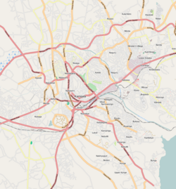
[edit]Kaleerwe is bordered by Kawempe to the north, Kyebando to the east, Makerere to the south, Bwaise to the southwest and Kazo to the west. It sandwiched between the Kampala-Masindi Highway to the west, the Kampala-Gayaza Highway to the east, the Kampala Northern Bypass Highway to the south. This location lies approximately 6 kilometres (3.7 mi), by road, north of Kampala's central business district.[3] The coordinates of Kaleerwe are:0°21'07.0"N, 32°34'19.0"E (Latitude:0.351950; Longitude:32.571950).[4]
Points of interest
[edit]- The Kampala Northern Bypass Highway, passes through the neighborhood in a general east to west direction.
- The Kampala-Gayaza Highway passes through the neighborhood in a north to south direction.
- The Kaleerwe Central Market
- The Lubigi wetland has its origins in the streams and drainage channels in Kaleerwe.
- A branch of Equity Bank (Uganda)
- A branch of Finance Trust Bank
- Diamond Impex Supermarket - Located along Kampala-Gayaza Highway.
See also
[edit]References
[edit]- ^ "Support The Plastic Recycling Company". New Vision. 28 January 2007. Archived from the original on 15 June 2014. Retrieved 14 June 2014.
- ^ Birungi, Harriet (17 November 2006). "Is Your House Flood-Protected?". New Vision. Archived from the original on 15 June 2014. Retrieved 14 June 2014.
- ^ "Map Showing Kampala And Kaleerwe With Distance Marker". Globefeed.com. Retrieved 14 June 2014.
- ^ "Location of Kaleerwe At Google Maps". Google Maps. Retrieved 14 June 2014.

