Lerdo Municipality
Lerdo | |
|---|---|
Lerdo City parade ground | |
| Coordinates: 25°46′N 103°31′W / 25.767°N 103.517°W | |
| Country | |
| State | Durango |
| Municipal seat | Ciudad Lerdo |
| Area | |
• Total | 1,868.8 km2 (721.5 sq mi) |
| Population (2010) | |
• Total | 141,043 |
| • Density | 75/km2 (200/sq mi) |

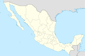
Lerdo is a municipality in the Mexican state of Durango. The municipal seat lies at Ciudad Lerdo. The municipality covers an area of 1868.8 km2.
As of 2010, the municipality had a total population of 141,043,[1] up from 129,191 as of 2005.[2]
As of 2010, the city of Lerdo had a population of 79,669.[1] Other than the city of Lerdo, the municipality had 485 localities, the largest of which (with 2010 populations in parentheses) were: Nazareno (7,515), Ciudad Juárez (7,069), La Loma (4,045), León Guzmán (3,335), Carlos Real (San Carlos) (3,021), El Huarache (El Guarache) (2,709), Villa de Guadalupe (2,376), classified as urban, and Juan E. García (2,457), Sapioris (1,866), San Jacinto (1,661), Los Ángeles (1,616), La Goma (1,522), Ejido 21 de Marzo (1,408), Seis de Enero (1,372), Álvaro Obregón (1,359), La Luz (1,285), Picardías (1,194), Las Cuevas (1,125), and El Rayo (1,030), classified as rural.[1]
References
[edit]- ^ a b c "Lerdo". Catálogo de Localidades. Secretaría de Desarrollo Social (SEDESOL). Retrieved 23 April 2014.
- ^ "Lerdo". Enciclopedia de los Municipios de México. Instituto Nacional para el Federalismo y el Desarrollo Municipal. Archived from the original on May 10, 2007. Retrieved December 15, 2008.

