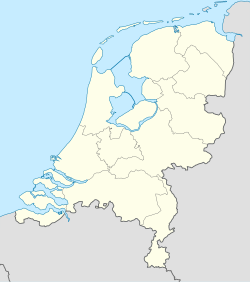
Malden, Netherlands
Appearance
Malden | |
|---|---|
Town | |
The plaza in front of the church | |
| Coordinates: 51°47′N 5°51′E / 51.783°N 5.850°E | |
| Country | Netherlands |
| Province | Gelderland |
| Municipality | Heumen |
| Area | |
• Total | 6.01 km2 (2.32 sq mi) |
| Elevation | 10 m (30 ft) |
| Population (2021)[1] | |
• Total | 10,930 |
| • Density | 1,800/km2 (4,700/sq mi) |
| Time zone | UTC+1 (CET) |
| • Summer (DST) | UTC+2 (CEST) |
| Postal code | 6581[1] |
| Dialing code | 024 |
Malden is a town in the Dutch municipality of Heumen, Gelderland. Malden is located straight to the south of the City of Nijmegen. Malden is also home to the town hall of Heumen.[3] Malden's football club is called SV Juliana '31.
History
[edit]The village was first mentioned in 1247 as de Maldene, and means people's meeting / court of justice.[4] Malden developed between the moraine and the river bank in the Early Middle Ages. Later, it developed into a linear settlement along the road (nowadays: N844).[5]
Malden was home to 680 people in 1840,[6] which increased to 10,930 by 2021.
Gallery
[edit]References
[edit]- ^ a b c "Kerncijfers wijken en buurten 2021". Central Bureau of Statistics. Retrieved 13 April 2022.
three entries
- ^ "Postcodetool for 6581AA". Actueel Hoogtebestand Nederland (in Dutch). Het Waterschapshuis. Retrieved 13 April 2022.
- ^ "Gemeentehuis". Heumen (in Dutch). Retrieved 13 April 2022.
- ^ "Malden - (geografische naam)". Etymologiebank (in Dutch). Retrieved 13 April 2022.
- ^ Ronald Stenvert & Sabine Broekhoven (2000). "Malden" (in Dutch). Zwolle: Waanders. ISBN 90 400 9406 3. Retrieved 13 April 2022.
- ^ "Malden". Plaatsengids (in Dutch). Retrieved 13 April 2022.


