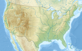
Mono Pond State Park Reserve
Appearance
| Mono Pond State Park Reserve | |
|---|---|
 Mono Pond | |
| Location | Columbia, Connecticut, United States |
| Coordinates | 41°40′47″N 72°18′39″W / 41.67972°N 72.31083°W[1] |
| Area | 218 acres (88 ha)[2] |
| Elevation | 541 ft (165 m)[1] |
| Established | 2008 |
| Administered by | Connecticut Department of Energy and Environmental Protection |
| Designation | Connecticut state park |
| Website | Official website |
Mono Pond State Park Reserve is a public recreation area covering 218 acres (88 ha) in the town of Columbia, Connecticut, 8 miles (13 km) southwest of Willimantic. The state park surrounds Mono Pond, a 113-acre (46 ha) body of water averaging depths of 3.5 feet (1.1 m) with an area near the dam reaching a depth of nine feet (2.7 m).[2][3] The park offers fishing, hiking, picnicking, cross-country skiing, bow hunting, and a boat launch for motorized (8-hp limit) and non-motorized boating.[2][4] The park is managed by the Connecticut Department of Energy and Environmental Protection and was added to the roll of Connecticut state parks in 2008.[5]
References
[edit]- ^ a b "Mono Pond". Geographic Names Information System. United States Geological Survey, United States Department of the Interior.
- ^ a b c "Other State Parks and Forests". Connecticut Department of Energy and Environmental Protection. Retrieved July 29, 2024.
- ^ "Mono Pond" (PDF). Connecticut Department of Energy and Environmental Protection. September 2011. Retrieved September 12, 2017.
- ^ "Mono Pond Boat Launch". Connecticut Department of Energy and Environmental Protection. January 25, 2023. Retrieved July 29, 2024.
- ^ "Other State Parks". State Register and Manual 2008. State of Connecticut. October 16, 2008. Retrieved December 6, 2017.
External links
[edit]- Other State Parks and Forests Connecticut Department of Energy and Environmental Protection

