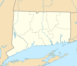
Monroe Center Historic District
Appearance
Monroe Center Historic District | |
 View across the town green to houses and a church, 2016 | |
| Location | CT 110 and CT 111, Monroe, Connecticut |
|---|---|
| Coordinates | 41°19′57″N 73°12′26″W / 41.33250°N 73.20722°W |
| Area | 120 acres (49 ha) |
| Built | 1762 |
| Architectural style | Colonial Revival, Georgian, Federal |
| NRHP reference No. | 77001392[1] |
| Added to NRHP | August 19, 1977 |
The Monroe Center Historic District is a 120-acre (49 ha) historic district in Monroe, Connecticut with significance dating to 1762. It was listed on the National Register of Historic Places in 1977.[1]
It includes about 60 significant buildings, including Federal style St. Peters Church at the south end of the Monroe Center green. On June 30, 1781, a dance was held on the green for about 600 French Army troops serving under General Rochambeau; they were camped nearby during their march towards Yorktown, Virginia which led to American independence.[2]
See also
[edit]Wikimedia Commons has media related to Monroe Center Historic District.
- March Route of Rochambeau's army
- List of historic sites preserved along Rochambeau's route
- National Register of Historic Places listings in Fairfield County, Connecticut
References
[edit]- ^ a b "National Register Information System". National Register of Historic Places. National Park Service. March 13, 2009.
- ^ T. Robins Brown (July 1976). "National Register of Historic Places Inventory-Nomination: Monroe Center Historic District". National Park Service. and Accompanying 15 photos, exterior and interior, from 1977
Categories:
- Houses on the National Register of Historic Places in Connecticut
- Georgian architecture in Connecticut
- Federal architecture in Connecticut
- Colonial Revival architecture in Connecticut
- Historic districts in Fairfield County, Connecticut
- Monroe, Connecticut
- Historic places on the Washington–Rochambeau Revolutionary Route
- National Register of Historic Places in Fairfield County, Connecticut
- Houses in Fairfield County, Connecticut
- Historic districts on the National Register of Historic Places in Connecticut
- Connecticut Registered Historic Place stubs

