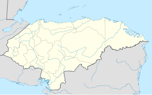
Nacaome
This article needs additional citations for verification. (February 2013) |
Nacaome | |
|---|---|
Municipality | |
Street view in Nacaome, Honduras | |
| Coordinates: 13°31′N 87°29′W / 13.517°N 87.483°W | |
| Country | Honduras |
| Department | Valle |
| Villages | 9 |
| Area | |
• Municipality | 589 km2 (227 sq mi) |
| Population (2023 projection)[1] | |
• Municipality | 63,991 |
| • Density | 110/km2 (280/sq mi) |
| • Urban | 30,462 |
| Time zone | UTC-6 (Central America) |
| Climate | Aw |
Nacaome, with a population of 21,310 (2023 calculation),[2] is the capital city of the Valle department of Honduras and the municipal seat of Nacaome Municipality. It is a manufacturing and commercial center located on the banks of the Nacaome River.
Nacaome is an old city founded when aboriginal Cholulas and Chaparrastiques, tired of fighting each other, thought it best to join together to build new houses in the middle of their territory on the west side of the Chapulapa River (the aboriginal name of the Nacaome River). They named the new town Naca-Ome, meaning "union of two races" in their dialects.[3] In Nahuatl Naca means race or body and Ome means two. This foundation happened before the Spanish conquerors came.
Nacaome was affected by Hurricane Stan in October 2005.
Demographics
[edit]At the time of the 2013 Honduras census, Nacaome municipality had a population of 57,345. Of these, 96.20% were Mestizo, 3.22% White, 0.47% Black or Afro-Honduran, 0.08% Indigenous and 0.03% others.[4]
References
[edit]- ^ Citypopulation.de Population of departments and municipalities in Honduras
- ^ Citypopulation.de Population of cities in Honduras
- ^ Banegas 1996, p. 5.
- ^ Instituto Nacional de Estadística (INE), bases de datos en línea
Sources
[edit]- Banegas, Ramon. "Historia de Nacaome". Banco Central de Honduras. Agosto 1996.
13°31′N 87°29′W / 13.517°N 87.483°W

