Nerežišća
Appearance
Nerežišća | |
|---|---|
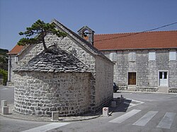
 Chapel with bonsai tree in the centre of the town | |
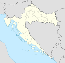
| Coordinates: 43°20′N 16°35′E / 43.333°N 16.583°E | |
| Country | |
| County | Split-Dalmatia |
| Area | |
• Total | 78.8 km2 (30.4 sq mi) |
| Population (2021)[2] | |
• Total | 878 |
| • Density | 11/km2 (29/sq mi) |
| Time zone | UTC+1 (CET) |
| • Summer (DST) | UTC+2 (CEST) |
| Website | nerezisca |
Nerežišća (Croatian pronunciation: [něreʒiːɕt͡ɕa]) is a village and a municipality on the island Brač in Croatia.
In the 2011 census, it had a total population of 862, in the following settlements:[3]
- Donji Humac, population 157
- Dračevica, population 89
- Nerežišća, population 616
In the same census, 98.84% were Croats.[4]
In the past, Nerežišća was the capital of the island.[5] It was founded inside the island, not on its coast, because of fear of pirates marauding the Adriatic Sea. Once these pirates were eradicated by the Venetians, the locals started populating the settlements by the sea, especially Supetar and Sutivan, across the Brač Channel facing Split.
References
[edit]- ^ Register of spatial units of the State Geodetic Administration of the Republic of Croatia. Wikidata Q119585703.
- ^ "Population by Age and Sex, by Settlements" (xlsx). Census of Population, Households and Dwellings in 2021. Zagreb: Croatian Bureau of Statistics. 2022.
- ^ "Population by Age and Sex, by Settlements, 2011 Census: Nerežišća". Census of Population, Households and Dwellings 2011. Zagreb: Croatian Bureau of Statistics. December 2012.
- ^ "Population by Ethnicity, by Towns/Municipalities, 2011 Census: County of Split-Dalmatia". Census of Population, Households and Dwellings 2011. Zagreb: Croatian Bureau of Statistics. December 2012.
- ^ Footprint Croatia by Jane Foster
External links
[edit]Wikimedia Commons has media related to Nerežišća.

