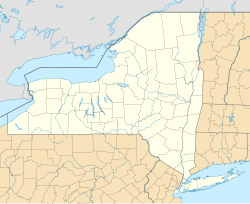
New Hackensack, New York
Appearance
New Hackensack, New York | |
|---|---|
| Coordinates: 41°37′17″N 73°52′8″W / 41.62139°N 73.86889°W | |
| Country | United States |
| State | New York |
| County | Dutchess |
| Town | Wappinger |
| Area | |
• Total | 2.08 sq mi (5.38 km2) |
| • Land | 2.08 sq mi (5.37 km2) |
| • Water | 0.00 sq mi (0.01 km2) |
| Elevation | 192 ft (59 m) |
| Population (2020) | |
• Total | 1,497 |
| • Density | 721.45/sq mi (278.55/km2) |
| Time zone | UTC-5 (Eastern (EST)) |
| • Summer (DST) | UTC-4 (EDT) |
| ZIP Code | 12590 (Wappingers Falls) |
| Area code | 845 |
| FIPS code | 36-50265 |
| GNIS feature ID | 2812764[2] |
New Hackensack is an unincorporated community and census-designated place (CDP) in the town of Wappinger in Dutchess County, New York, United States. It was first listed as a CDP prior to the 2020 census.[2]
New Hackensack is in western Dutchess County, in the northeastern section of Wappinger. It is bordered to the southwest by the Myers Corner CDP and to the west by the Hudson Valley Regional Airport, formerly known as Dutchess County Airport and originally known as "New Hackensack Field" in the 1930s and 1940s. New York State Route 376 passes through the community, leading north 7 miles (11 km) to Poughkeepsie and southeast 5 miles (8 km) to Hopewell Junction. Wappingers Falls is 3 miles (5 km) to the southwest.
Demographics
[edit]| Census | Pop. | Note | %± |
|---|---|---|---|
| 2020 | 1,497 | — | |
| U.S. Decennial Census[3] | |||
References
[edit]- ^ "ArcGIS REST Services Directory". United States Census Bureau. Retrieved September 20, 2022.
- ^ a b "New Hackensack Census Designated Place". Geographic Names Information System. United States Geological Survey, United States Department of the Interior.
- ^ "Census of Population and Housing". Census.gov. Retrieved June 4, 2016.


