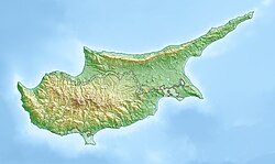
Palaichori Oreinis
Appearance
Palaichori Oreinis
Παλαιχώρι Ορεινής | |
|---|---|
Village | |
| Coordinates: 34°55′19″N 33°05′38″E / 34.92194°N 33.09389°E | |
| Country | |
| District | Nicosia District |
| Elevation | 2,251 ft (686 m) |
| Population (2001)[1] | |
• Total | 333 |
| Time zone | UTC+2 (EET) |
| • Summer (DST) | UTC+3 (EEST) |
| Website | www |
Palaichori Oreinis (Greek: Παλαιχώρι Ορεινής) is a village located in the Nicosia District of Cyprus on the E 903 road. The village stands at an altitude of 930 m.[2] Palaichori Oreinis is separated by Palaichori Morphou by the Serrache River.[2] The two villages are known collectively as Palaichori.
The village contains a 16th-century church, Metamorfosis tou Sotiros (Greek: Μεταμορφώσης του Σωτήρος). The church is one of the ten Painted Churches in the Troödos Region, which were inscribed as a UNESCO World Heritage Site in 1985 because of their outstanding frescoes and testimony to the history of Byzantine rule in Cyprus.[3]
References
[edit]- ^ Census 2001
- ^ a b Discover Palaichori
- ^ "Painted Churches in the Troödos Region". UNESCO World Heritage List. United Nations Educational, Scientific, and Cultural Organization. Retrieved 30 May 2021.
External links
[edit]- Official website (in Greek and English)
- palaichori.com Guide to the Village of Palaichori (in English)

