Sarmato
This article needs additional citations for verification. (August 2023) |
Sarmato | |
|---|---|
| Comune di Sarmato | |
Sarmato City Hall | |
| Coordinates: 45°4′N 9°29′E / 45.067°N 9.483°E | |
| Country | Italy |
| Region | Emilia-Romagna |
| Province | Province of Piacenza (PC) |
| Area | |
• Total | 27.0 km2 (10.4 sq mi) |
| Population (Dec. 2004)[2] | |
• Total | 2,714 |
| • Density | 100/km2 (260/sq mi) |
| Demonym | Sarmatesi |
| Time zone | UTC+1 (CET) |
| • Summer (DST) | UTC+2 (CEST) |
| Postal code | 29010 |
| Dialing code | 0523 |
| Website | Official website |
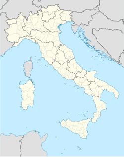
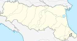
Sarmato (Piacentino: Särmat) is a comune (municipality) in the Province of Piacenza in the Italian region Emilia-Romagna, located about 160 kilometres (99 mi) northwest of Bologna and about 15 kilometres (9 mi) west of Piacenza. As of 31 December 2004, it had a population of 2,714 and an area of 27.0 square kilometres (10.4 sq mi).[3] Sarmato borders the following municipalities: Borgonovo Val Tidone, Castel San Giovanni, Monticelli Pavese, Pieve Porto Morone, Rottofreno.
Geography
[edit]The town and its municipal area are located in the Po valley, by the Po and Tidone rivers. The municipality is situated at north-west area of province of Piacenza and it borders with province of Pavia in Lombardy. Sarmato borders the following municipalities: Castel San Giovanni, Borgonovo Val Tidone, Rottofreno, Pieve Porto Morone (PV) and Monticelli Pavese (PV).
The municipal area includes main town and also following boroughs: Agazzino, Cà dell’Acqua, Casoni, Cepone, Coste di Sotto, Madonna del Rosario, Nosone, Ponte Tidone, Salumificio and Veratto. Near Veratto, the Tidone flows into the Po.
Climate
[edit]Sarmato belongs to climate zone E.[4] It has a continental climate with hot and wet summer, and cold and wet winter. During fall and winter, fog is often frequently present.
Economy
[edit]The main economy activity is agriculture. The principal plantations are: cereals (mainly wheat and mais), fodder and vegetables (especially tomato). An important branch is zootechnics, especially bovine farming. Regarding industries, there are advanced food factories, building factories, metalworking factories and factories that produce glass, plastic and rubber. A tertiary sector is composed of small network of stores, services and banks. Every Friday morning there is a weekly market.
Transportation
[edit]The Padana Inferiore state road crosses the municipal area, and it is the main access way.
Sarmato is on bus line Piacenza-Nibbiano Caminata served by SETA.
Railway station is located on line Alessandria-Piacenza.
The A21 Torino Piacenza highway crosses the municipal area. The closet tool booth highway is tool booth of Castel San Giovanni (located on A21 highway) and it is distant almost 8 km.
The closet main airports are Malpensa, Linate e Orio al Serio.
Between 1893 and 1938 Sarmato was on tram line Piacenza-Pianello-Nibbiano.
Demographic evolution
[edit]Citizens recorded.

Ethnic groups
[edit]On the date 31 December 2012 the foreign inhabitants in municipality of Sarmato are 538[6] and they represent the 18.2% of population. The nations more represented are:
| Country | Population (2012) | Percentage % |
|---|---|---|
| Morocco | 128 | 23,8 |
| Romania | 102 | 19,0 |
| Albania | 82 | 15,2 |
| Tunisia | 37 | 6,9 |
| Bosnia-Herzegovina | 25 | 4,6 |
| Ukraine | 24 | 4,5 |
Government and administration
[edit]Following table is the history of the municipal administrations.
| Start Mandate | End Mandate | Mayor | Party |
|---|---|---|---|
| 26 June 1985 | 25 May 1990 | Luigi Bozzini | Italian Communist Party |
| 25 May 1990 | 24 April 1995 | Rino Curtoni | N.A. |
| 24 April 1995 | 14 June 1999 | Sergio Romanini | Civil List |
| 14 June 1999 | 16 August 2003 | Mauro Torregiani | Civil List |
| 14 June 2004 | 6 August 2009 | Sabrina Gallinari | Civil List |
| 6 August 2009 | 26 May 2014 | Anna Tanzi | Popolo delle libertà and Lega Nord |
| 26 May 2014 | Available | Anna Tanzi | Civil List |
Sport
[edit]The soccer team of Sarmato is FCD Sarmatese that currently play in prima categoria league. The team has youth sectors.
There are:
- a soccer field for 11 players (playground of FCD Sarmatese team)
- a soccer field for 7 players (near the church)
- an outdoor soccer field for 5 players (in synthetic grass)
- an outdoor basketball field
- a swimming pool with two beach volley fields
- a multipurpose gymnasium used also for basketball and volleyball)
References
[edit]- ^ "Superficie di Comuni Province e Regioni italiane al 9 ottobre 2011". Italian National Institute of Statistics. Retrieved 16 March 2019.
- ^ "Popolazione Residente al 1° Gennaio 2018". Italian National Institute of Statistics. Retrieved 16 March 2019.
- ^ All demographics and other statistics: Italian statistical institute Istat.
- ^ "Comuni Italiani.it Clima e dati geografici". Retrieved 25 May 2013.


