Shimokoma Station
 Shimokoma Station, October 2006 | |||||||
| General information | |||||||
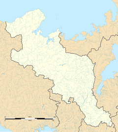
| Location | Shimoshinjo Shimokoma, Seika-cho, Soraku-gun, Kyoto-fu 619-0245 Japan | ||||||
| Coordinates | 34°46′49.92″N 135°47′18.55″E / 34.7805333°N 135.7884861°E | ||||||
| Operated by | |||||||
| Line(s) | H Katamachi Line | ||||||
| Distance | 7.4 km (4.6 miles) from Kizu | ||||||
| Platforms | 1 side platform | ||||||
| Tracks | 1 | ||||||
| Connections | |||||||
| Construction | |||||||
| Structure type | Ground level | ||||||
| Other information | |||||||
| Station code | JR-H21 | ||||||
| Website | Official website | ||||||
| History | |||||||
| Opened | 1 December 1952 | ||||||
| Passengers | |||||||
| 2019 | 456 daily | ||||||
| |||||||
Shimokoma Station (下狛駅, Shimokoma-eki) is a passenger railway station located in the town of Seika, Kyoto, Japan. There is a transfer at this station to the nearby Komada Station on the Kintetsu Kyoto Line.
Lines
[edit]Shimokoma Station is served by the Katamachi Line (Gakkentoshi Line), and is located at 7.4 km (4.6 miles) from the terminus of the line at Kizu.
Layout
[edit]The station has one side platform serving a single bi-directional track.
Stations next to Shimokoma
[edit]| « | Service | » | ||
|---|---|---|---|---|
| Katamachi Line (Gakkentoshi Line) | ||||
| Hōsono | Rapid Service | JR Miyamaki | ||
| Hōsono | Regional Rapid Service | JR Miyamaki | ||
| Hōsono | Local | JR Miyamaki | ||
History
[edit]Shimokoma Station opened on 1 December 1952. With the privatization of Japanese National Railways (JNR) on 1 April 1987, the station came under the control of JR West. Station numbering was introduced in March 2018 with Shimokoma being assigned station number JR-H21.[1][2]
Passenger statistics
[edit]In fiscal 2019, the station was used by an average of 456 passengers daily.[3]
Surrounding area
[edit]- Komada Station - Kintetsu Kyoto Line
- Kyoto Kogakukan High School
- Kyoto Prefectural University Seika Campus
See also
[edit]References
[edit]- ^ "近畿エリアの12路線 のべ300駅に「駅ナンバー」を導入します!" ["Station numbers" will be introduced at a total of 300 stations on 12 lines in the Kinki area!]. westjr.co.jp (in Japanese). 20 July 2016. Archived from the original on 16 November 2022. Retrieved 30 December 2022.
- ^ "「駅ナンバー」一覧表" ["Station number" list] (PDF). westjr.co.jp (in Japanese). 20 July 2016. Archived from the original (PDF) on 16 November 2022. Retrieved 30 December 2022.
- ^ Kyoto Prefecture Statistical Yearbook


