Straumen, Trøndelag
Appearance
Straumen | |
|---|---|
Village | |
 View of the village | |
| Coordinates: 63°52′18″N 11°17′46″E / 63.8716°N 11.2962°E | |
| Country | Norway |
| Region | Central Norway |
| County | Trøndelag |
| District | Innherred |
| Municipality | Inderøy |
| Area | |
• Total | 1.35 km2 (0.52 sq mi) |
| Elevation | 8 m (26 ft) |
| Population (2018)[1] | |
• Total | 1,670 |
| • Density | 1,237/km2 (3,200/sq mi) |
| Time zone | UTC+01:00 (CET) |
| • Summer (DST) | UTC+02:00 (CEST) |
| Post Code | 7670 Inderøy |
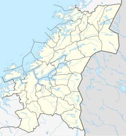
Straumen is the administrative centre of the municipality of Inderøy in Trøndelag county, Norway. It is located along the Trondheimsfjord at the northeastern side of the Inderøya peninsula, next to the Børgin fjord. The village lies about 2 kilometres (1.2 mi) east of the village of Sakshaug and about 7 kilometres (4.3 mi) west of the villages of Røra and Hylla. The village has a slaughterhouse, a folk high school, and a museum. The Sakshaug Church and the historic Old Sakshaug Church lie just west of Straumen.[3]
The 1.35-square-kilometre (330-acre) village has a population (2018) of 1,670 and a population density of 1,237 inhabitants per square kilometre (3,200/sq mi).[1]
Media gallery
[edit]-
View of the village
-
Typical street and houses
-
View of the village from a distance
-
Retirement home
-
Bølge
-
Park in Straumen
-
Bridge towards Røra
References
[edit]- ^ a b c Statistisk sentralbyrå (1 January 2018). "Urban settlements. Population and area, by municipality".
- ^ "Straumen, Inderøy (Trøndelag)". yr.no. Retrieved 2018-04-14.
- ^ Thorsnæs, Geir, ed. (2017-11-29). "Straumen – Inderøy". Store norske leksikon (in Norwegian). Kunnskapsforlaget. Retrieved 2018-04-14.
Wikimedia Commons has media related to Straumen, Inderøy.


