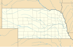
Tamora, Nebraska
Tamora | |
|---|---|
View of Tamora from the northeast, July 2010 | |
| Coordinates: 40°53′40″N 97°13′31″W / 40.89444°N 97.22528°W[1] | |
| Country | United States |
| State | Nebraska |
| County | Seward |
| First settled | 1879 |
| Area | |
• Total | 0.99 sq mi (2.58 km2) |
| • Land | 0.99 sq mi (2.56 km2) |
| • Water | 0.01 sq mi (0.02 km2) |
| Elevation | 1,558 ft (475 m) |
| Population (2020) | |
• Total | 44 |
| • Density | 44.53/sq mi (17.19/km2) |
| Time zone | UTC-6 (Central (CST)) |
| • Summer (DST) | UTC-5 (CDT) |
| ZIP code | 68434 |
| Area code | 402 |
| FIPS code | 31-48340 |
| GNIS feature ID | 2583900[1] |
Tamora (/təˈmɔːrə/ tə-MOR-ə) is a census-designated place in Seward County, Nebraska, United States. The community presently consists of a large grain elevator complex and a small residential district, with a population of about 70.
History
[edit]In 1877, the Burlington Railroad extended its tracks westward from Seward, Nebraska. In 1879, four men each donated 10 acres (4.0 ha) of land for a townsite, in order to persuade the railroad to build a siding and station there.[3] A dispute arose over the name of the new town, since each of the four wanted it to bear his name. The name eventually chosen was a frontier pronunciation of "tomorrow", apparently because the selection of the name had to be deferred until later.[4]
Within three years of the town's founding, three grain elevators had been constructed.[3] In 1884, the population was estimated at 53; the town was incorporated in 1888.[5] Eventually, Tamora's commercial district consisted of over thirty businesses, including two banks and the Tamora Times newspaper.[3]
In 1892, an abortive attempt was made to bring the Seward County seat to Tamora. A group of local promoters purchased a quarter-block and began construction of a building that they hoped would become the courthouse. However, support for the idea failed to materialize, and the building project was abandoned. A few years later, an attempt was made to build an opera house on the unfinished foundation. This, too, failed; and the basement was eventually filled in.[5]
By 1920, Tamora had a population of over 200.[5] However, it lacked a fire department. Many of its commercial buildings were destroyed by fire and not replaced.[3] The population steadily declined, to a low of 50 in 1980.[6] The post office was closed in 1970.[7]
Even as the retail sector and the population declined, the grain storage and loading facilities were expanded. In 1962, the local farmers' cooperative built a concrete grain elevator; in 1964, they replaced a feed mill that had burned down. In 1978, they built one of the largest grain elevators in Nebraska.[5]
Disharmony on the village board led to a number of recall attempts and, eventually, a petition to unincorporate the town, which was rejected by the voters in a 1990 election.[5] Feuding on the board continued; and in 1997, Tamora's electors voted 30-6 in favor of unincorporation.[8]
In 1990, the last decennial census before its unincorporation, the population of Tamora was reported as 51.[9] In 2007, the population was estimated at 70.[3]
Geography
[edit]Tamora lies 6 miles (10 km) west of the county seat of Seward,[5] about halfway between Seward and Utica. It is located approximately one-half mile (0.8 km) south of U.S. Route 34,[10] on the BNSF Railway.[5]
Demographics
[edit]| Census | Pop. | Note | %± |
|---|---|---|---|
| 2020 | 44 | — | |
| U.S. Decennial Census[11] | |||
Economy
[edit]Tamora has no commercial district. Its principal business is the grain elevator operated by United Farmers Cooperative. The elevator has unit train capability.[5] It has a capacity of 2,318,000 US bushels (81,700 m3), and its siding has space for 110 railroad cars.[12]
See also
[edit]References
[edit]- ^ a b c U.S. Geological Survey Geographic Names Information System: Tamora, Nebraska
- ^ "ArcGIS REST Services Directory". United States Census Bureau. Retrieved September 18, 2022.
- ^ a b c d e Seward County, Nebraska Historic Buildings Survey.[usurped] Nebraska State Historical Society.[usurped] August 2007. Retrieved 2010-09-03.
- ^ Fitzpatrick, Lilian Linder (1925). "Nebraska Place-Names". University of Nebraska Department of English. Retrieved 2010-09-02.
- ^ a b c d e f g h Ihde-Gray, Vickey. Tamora—Seward County. Nebraska... Our Towns Retrieved 2010-09-03.
- ^ "Population of Nebraska incorporated places, 1930 to 1980". Nebraska Department of Economic Development. Retrieved 2010-09-05.
- ^ "Place names for Seward County Nebraska". Seward County Nebraska. Retrieved 2010-09-05.
- ^ Bauer, Scott. "Nebraska's Voters Often Reckless With Recalls". Los Angeles Times. 1999-10-17. Retrieved 2010-09-03.
- ^ "Population of Nebraska incorporated places: Nebraska--1990 and 2000". Nebraska Department of Economic Development. Retrieved 2010-09-05.
- ^ Nebraska Atlas & Gazetteer. Freeport, Maine: Delorme. 1st edition, 1996. p. 65.
- ^ "Census of Population and Housing". Census.gov. Retrieved June 4, 2016.
- ^ "United Farmers Cooperative—Tamora, Nebraska". BNSF Grain Elevator Directory. Retrieved 2010-09-05.
External links
[edit]![]() Media related to Tamora, Nebraska at Wikimedia Commons
Media related to Tamora, Nebraska at Wikimedia Commons


