Tiquié River
| Tiquié River | |
|---|---|
| Location | |
| Country | Brazil, Colombia |
| Physical characteristics | |
| Source | |
| • location | Amazon River, Amazonas, Brazil |
| • coordinates | 0°5′35.81″N 68°32′20.11″W / 0.0932806°N 68.5389194°W |
| Mouth | |
• location | Vaupés River, Vaupés, Colombia |
• coordinates | 0°15′12.4″N 70°2′52.7″W / 0.253444°N 70.047972°W |
| Length | 374 km (232 mi) |
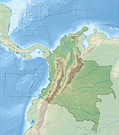
The Tiquié River is a tributary stream of the Vaupés River. It runs between the Vaupés and the state of Amazonas, in the border region between Colombia and Brazil. It is a black water river. Its length is 374 km according to satellite measurements. It originates in Colombian territory and runs 321 km (199 mi) through Brazil.[1]
Geography
[edit]The terrain around the Tiquié River is mainly flat. It is located in a valley and rises 77 m (253 ft) above sea level. The Tiquié flows into São Gabriel da Cachoeira, forming Lake Mucum in the Vaupés with a surface area of 35 square kilometers. The highest point nearby reaches 114 m (374 ft) and 1.2 km (0.75 mi) southwest of the Tiquié River.[2] In the upper Tiquie, the mainland forest predominates, while in the middle and lower course of the river the catinga predominates. The vegetation typical of the flooded lands known as igapó abounds, especially dynamic in the lower course.[1]
The tropical jungle climate prevails in the area.[3] The average annual temperature in the area is 22 °C. The warmest month is January, when the average temperature is 23 °C, and the coldest is May, with 21 °C.[4] The wettest month is February, with an average of 515 mm of precipitation, and the wettest October is dry, with 211 mm of precipitation.[5] The average annual precipitation is 2,900 to 3,600 millimeters.[1]
The Tiquié basin is inhabited by the indigenous peoples Macuna, Tuyuca, Tukano, Bará, Desano, Hudpa and Yuhupdeh.[1]
References
[edit]- ^ a b c d Cabalzar, Aloisio; Flavio Lima; Mauro C. López (2005). Peixe e Genteno Alto Rio Tiquié (in Portuguese). Instituto Socioambiental. Retrieved 2 October 2021.
- ^ "Viewfinder Panoramas Digital elevation Model". Viewfinderlänk (in Swedish). Retrieved 2015-06-21.
- ^ Updated world map of the Köppen-Geiger climate classification. Vol. 11. Hydrology and Earth System Sciences. 2007. p. 1633-1644. Retrieved 2016-01-30.
- ^ "NASA Earth Observations Data Set Index". NASA. Archived from the original on 10 May 2020. Retrieved 30 January 2016.
- ^ Tropical Rainfall Monitoring Mission. "NASA Earth Observations: Rainfall (1 month - TRMM)". NASA. Archived from the original on 19 April 2019. Retrieved 30 January 2016.

