Torodi
Torodi | |
|---|---|
 Torodi in 2009 | |
| Coordinates: 13°07′N 1°48′E / 13.117°N 1.800°E | |
| Country | |
| Region | Tillaberi Region |
| Department | Say Department |
| Area | |
• Commune | 2,179 sq mi (5,643 km2) |
| Population (2012 census) | |
• Commune | 109,342 |
| • Density | 50/sq mi (19/km2) |
| • Urban | 11,813 |
| Time zone | UTC+1 (WAT) |
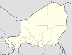
Torodi is a small town and a rural commune in Niger. As of 2012, it had a population of 109,342.[1] As a rural center, Torodi hosts a large weekly market and the seat of local tribal authority (canton).[2] Torodi is in the Say Department of the Tillaberi Region, which surrounds the national capital, Niamey. Say Department, with its capital at the large Niger River town of Say, abuts Niamey to the southwest and across the river to the west. The town of Torodi lies about 60 km due west of the city of Say and 50 km east of the border with Burkina Faso. Torodi itself lies on a tributary of the Niger, the Gourbi river.
Torodi has historically been a crossroads of Zarma and Songhay people form the north, and the Gourma people, who dominated most of the area that is now Say Department until the 18th century CE. The 18th century saw expansion of Fulani people, south along the Niger from Gao and the Inland Niger Delta, as well as east from what is now northeast Burkina Faso. While the dominant Fulani Muslim Emirates of this period were based in Liptako to the north and Say to the east, Torodi itself was capital of a smaller Fulani state, which persisted into the colonial period.[3]
Torodi rural commune includes several villages, supported by seasonal millet agriculture, pastoral cattle raising, and the collection of firewood to be sold in Niamey.[4]
See also
[edit]- Liptako: the culturally similar historic region and Emirate to the north and west of Torodi
- Tera Department directly to the north
References
[edit]- ^ "Torodi (Commune, Niger) - Population Statistics, Charts, Map and Location". www.citypopulation.de. Retrieved 2024-02-16.
- ^ Loi n° 2002-014 du 11 JUIN 2002 portant création des communes et fixant le nom de leurs chefs-lieux. Includes list of 213 communes rurales and seats, 52 Communes urbaines and seats
- ^ Gado (1980) 36-48 on Gourma Zarma conflict, 59-61 for the foundation of the Torodi Emirate.
- ^ Niger : le puits pastoral de Diankoundi: audio report (2'22") and written summary. Radio France International, broadcast 10 July 2011. The report focuses on the Torodi commune village of Diankoundi.
- Gado, Boubé (1980). Le Zarmatarey. Contribution à l'histoire des populations d'entre Niger et Dallol Mawri. Études Nigériennes series (No. 45). Niamey: Institut de Recherches en Sciences Humaines. ISBN 2-85921-045-8.pp. 11, 36-48, 59-61, 119, 239.
Further reading
[edit]. Giraut F., 1994, La petite ville, un milieu adapté aux paradoxes de l'Afrique de l'Ouest : étude sur le semis, et comparaison du système spatial et social de sept localités : Badou et Anié (Togo) ; Jasikan et Kadjebi (Ghana) ; Torodi, Tamaské et Keïta (Niger), PHD Thesis in geography, Paris I La Sorbonne. [1]
13°07′N 1°48′E / 13.117°N 1.800°E
