Bandy, Virginia
From Infogalactic: the planetary knowledge core
| Bandy, Virginia | |
|---|---|
| Unincorporated community | |
| State Road 627 in Bandy
State Road 627 in Bandy
|
|
| Coordinates: Lua error in package.lua at line 80: module 'strict' not found. | |
| Country | United States |
| State | Virginia |
| County | Tazewell |
| Elevation | 2,119 ft (646 m) |
| Time zone | Eastern (EST) (UTC-5) |
| • Summer (DST) | EDT (UTC-4) |
| ZIP code | 24602 |
| Area code(s) | 276 |
| GNIS feature ID | 1492508[1] |
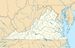
Bandy is an unincorporated community in Tazewell County, Virginia, United States. Bandy is located at the junction of State Routes 624 and 627, 3.4 miles (5.5 km) northeast of Richlands. Bandy has a post office with ZIP code 24602.[2][3]
The community was named for early settler William W. "Billy" Bandy.[4]

