Charters Towers Airport
From Infogalactic: the planetary knowledge core
| Charters Towers Airport | |||||||||||||||
|---|---|---|---|---|---|---|---|---|---|---|---|---|---|---|---|
| File:Charters Towers Airport overview Vabre.jpg
Airport overview
|
|||||||||||||||
| IATA: CXT – ICAO: YCHT | |||||||||||||||
| Summary | |||||||||||||||
| Airport type | Public | ||||||||||||||
| Operator | Charters Towers Regional Council | ||||||||||||||
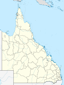
| Location | Charters Towers, Queensland | ||||||||||||||
| Elevation AMSL | 955 ft / 291 m | ||||||||||||||
| Coordinates | Lua error in package.lua at line 80: module 'strict' not found. | ||||||||||||||
| Map | |||||||||||||||
| Location in Queensland | |||||||||||||||
| Runways | |||||||||||||||
|
|||||||||||||||
Charters Towers Airport (IATA: CXT, ICAO: YCHT) is an airport located 2.9 nautical miles (5.4 km; 3.3 mi) north[1] of Charters Towers, Queensland, Australia.
History
World War II
During World War II, the United States Army Air Forces Fifth Air Force stationed the following units at the airfield:[2]
- No. 22 Squadron RAAF, A-20 Boston
- 3d Bombardment Group, (10 March 1942 – 28 January 1943) (Headquarters)
- 8th Bombardment Squadron, A-20 Havoc (17–31 March 1942; 9 May 1942 – 28 January 1943)
- 90th Bombardment Squadron, A-20 Havoc (8 March 1942 – 28 January 1943)
- 431st Fighter Squadron (475th Fighter Group), P-38 Lightning (14 May-1 July 1943)
- 432d Fighter Squadron (475th Fighter Group), P-38 Lightning (14 May-11 July 1943)
- 433d Fighter Squadron (475th Fighter Group), P-38 Lightning (14 May-17 June 1943)
- 16th Bombardment Squadron (Light) (27th Bombardment Group (Light)), A-24 Dauntless (1 April-4 May 1942)
- 17th Bombardment Squadron (Light) (27th Bombardment Group (Light)), A-24 Dauntless (1 April-4 May 1942)
- 91st Bombardment Squadron (Light) (27th Bombardment Group (Light)), A-24 Dauntless (24 March 1942)
In addition, 370th Service Squadron managed the day to day USAAF Base operations of the airfield.
See also
References
![]() This article incorporates public domain material from websites or documents of the Air Force Historical Research Agency.
This article incorporates public domain material from websites or documents of the Air Force Historical Research Agency.
- ↑ 1.0 1.1 YCHT – Charters Towers (PDF). AIP En Route Supplement from Airservices Australia, effective 3 March 2016
- ↑ Lua error in package.lua at line 80: module 'strict' not found.
External links
| Wikimedia Commons has media related to Charters Towers Airport. |
Categories:
- Use Australian English from May 2013
- All Wikipedia articles written in Australian English
- Use dmy dates from April 2011
- Pages with broken file links
- Wikipedia articles incorporating text from the Air Force Historical Research Agency
- Commons category link is defined as the pagename
- Airports in Queensland
- Airfields of the United States Army Air Forces in Australia
- Charters Towers

