Coyutla
From Infogalactic: the planetary knowledge core
| Coyutla | |
|---|---|
| Municipality | |
 |
|
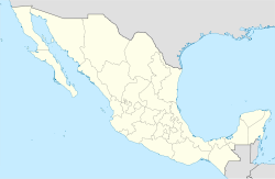
| Location of Coyutla within Mexico | |
| Coordinates: Lua error in package.lua at line 80: module 'strict' not found. | |
| Country | |
| State | Veracruz |
| Government | |
| • Municipal President | Florencio Sosa Candanedo |
| Area | |
| • Total | 312.6 km2 (120.7 sq mi) |
| Population | |
| • Total | 20 843 |
| • Density | 66.68/km2 (172.7/sq mi) |
| Time zone | CST (UTC-6) |
| • Summer (DST) | CDT (UTC-7) |
| Website | Official Website |
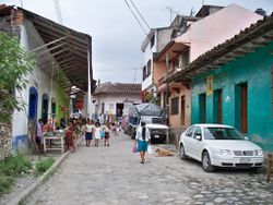
Coyutla is a municipality in Veracruz, Mexico. It is located in central zone of the State of Veracruz, about 110 km from state capital Xalapa. It has a surface of 312.56 km2. It is located at Lua error in package.lua at line 80: module 'strict' not found..
The municipality is delimited to the north and to the west by Puebla State, to the east by Espinal, to the south by Chumatlan, and to the south-west by Coahuitlan.[1]
It produces principally maize, beans and chili pepper.
A celebration in honor of San Pedro and San Pablo, patrons of the town, takes place in June.
The weather in Coyutla is warm-medium all year with rains in summer and autumn. A river runs nearby which has attractive views.
References
- ↑ Lua error in package.lua at line 80: module 'strict' not found.
External links
- (Spanish) Municipal Official webpage
- (Spanish) Municipal Official Information

