Mahira
| Mahira মাহিরা |
|
|---|---|
| Town | |
| Location in West Bengal, India | |
| Coordinates: Lua error in package.lua at line 80: module 'strict' not found. | |
| Country | |
| State | West Bengal |
| District | Barddhaman |
| Population (2001) | |
| • Total | 4,492 |
| Languages | |
| • Official | Bengali, English |
| Time zone | IST (UTC+5:30) |
| Lok Sabha constituency | Asansol |
| Vidhan Sabha constituency | Raniganj |
| Website | bardhaman |
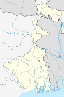
Mahira is a census town under Andal police station[1] of Durgapur subdivision in Barddhaman district in the Indian state of West Bengal.
Contents
Geography
Mahira is located at Lua error in package.lua at line 80: module 'strict' not found..
The Asansol-Durgapur region is composed of undulating latterite soil. This area lies between two mighty rivers – the Damodar and the Ajay. They flow almost parallel to each other in the region – the average distance between the two rivers is around 30 km. For ages the area was heavily forested and infested with plunderers and marauders. The discovery of coal led to industrialisation of the area and most of the forests have been cleared.[2]
Demographics
As of 2001[update] India census,[3] Mahira had a population of 4,492. Males constitute 56% of the population and females 44%. Mahira has an average literacy rate of 61%, higher than the national average of 59.5%: male literacy is 70%, and female literacy is 49%. In Mahira, 12% of the population is under 6 years of age.
Education
Mahira has one primary school.[4]
References
- ↑ District-wise list of stautory towns
- ↑ Chattopadhyay, Akkori, Bardhaman Jelar Itihas O Lok Sanskriti (History and Folk lore of Bardhaman District.), (Bengali), Vol I, pp 14-15, Radical Impression. ISBN 81-85459-36-3
- ↑ Lua error in package.lua at line 80: module 'strict' not found.
- ↑ 7th All-India School Education Survey 2003
