Pomeroy, Pennsylvania
From Infogalactic: the planetary knowledge core
| Pomeroy, Pennsylvania | |
|---|---|
| Census-designated place | |
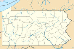
| Location within the state of Pennsylvania | |
| Coordinates: Lua error in package.lua at line 80: module 'strict' not found. | |
| Country | United States |
| State | Pennsylvania |
| County | Chester |
| Township | Sadsbury |
| Area | |
| • Total | 0.33 sq mi (0.86 km2) |
| • Land | 0.33 sq mi (0.85 km2) |
| • Water | 0.004 sq mi (0.01 km2) |
| Elevation | 484 ft (148 m) |
| Population (2010) | |
| • Total | 401 |
| • Density | 1,200/sq mi (470/km2) |
| Time zone | Eastern (EST) (UTC-5) |
| • Summer (DST) | EDT (UTC-4) |
| ZIP code | 19367 |
| Area code(s) | 610 and 484 |
| FIPS code | 42-61968 |
Pomeroy is a census-designated place (CDP) in Sadsbury Township, Chester County, Pennsylvania, United States. The population was 401 at the 2010 census.[1]
It was once the northern terminus of the Pomeroy and Newark Railroad.
Geography
Pomeroy is located at Lua error in package.lua at line 80: module 'strict' not found.[2] in the southeast corner of Sadsbury Township. Pennsylvania Route 372 passes through the center of the village, connecting Coatesville 3 miles (5 km) to the east with Parkesburg 1 mile (1.6 km) to the west.
According to the United States Census Bureau, the CDP has a total area of 0.33 square miles (0.86 km2), of which 0.33 square miles (0.85 km2) is land and 0.004 square miles (0.01 km2), or 0.88%, is water.[3]

