東経129度線
表示
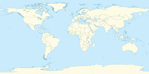
東経129度線(とうけい129どせん)は、本初子午線面から東へ129度の角度を成す経線である。北極点から北極海、アジア、太平洋、オーストラリア、インド洋、南極海、南極大陸を通過して南極点までを結ぶ。東経129度線は西経51度線と共に大円を形成する。
通過する国・地点
[編集]東経129度線は、北極点から南極点まで南に向かって以下の場所を通っている。
オーストラリア
[編集]
オーストラリアでは、東経129度線が西オーストラリア州の東の境になっており、ノーザンテリトリー・南オーストラリア州と接する。西オーストラリア州の境界とノーザンテリトリー・南オーストラリア州の境界の交点は南緯26度であり、その地点はサーベイヤー・ジェネラルズ・コーナーと呼ばれている[3]。
出典
[編集]- ^ Darby, Andrew (22 December 2003). “Canberra all at sea over position of Southern Ocean”. The Age 13 January 2013閲覧。
- ^ “Indian Ocean”. Encyclopaedia Britannica. 13 January 2013閲覧。
- ^ Porter, John, Surveyor-General of South Australia (1990年4月). AN HISTORICAL PERSPECTIVE - Longitude 129 degrees east, and why it is not the longest, straight line in the world. National Perspectives: 32nd Australian Surveyors Congress Technical Papers 31 March - 6 April 1990. Canberra: The Institution: Eyepiece - Official Organ of The Institution of Surveyors, Australia, W.A. Division (published 1990年6月). pp. 18–24. Porter。. 2012年1月16日閲覧。

