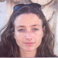
Rubini Santha
My expertise is on connecting the right spatial data with the right geohazard models. My focus is on disaster mapping and recovery using GIS and remote sensing.
My interests for disaster management started during my masters program, where I created flood inundation map and studied its impact on land use in Madurai. I chose a topic related to disasters for my PhD and focused more on the importance of choosing the correct terrain models for disaster mapping. I chose landslides in particular, because of the magnitude of the losses it incurs across the globe.
I worked as a modeler in Risk Management Solutions for North America earthquake project. I was involved in developing landslide hazard components for the main land US.
Please contact me for landslide inventory for Nepal and other hazard modeling factors such as elevation derivatives, recent NDVI, precipitation, geology,TWI, and fault databases for Asian countries.
I work on enriching the "Risk bundles for geohazards" which has high resolution and intelligent data layers. Risk bundle suite can assist catastrophe modelers in executing their deterministic and probabilistic models on several geohazards such as earthquake, landslides, liquefaction, floods, and shore line hazards. It is an one stop solution to address problems related to all the major perils.
To learn more please send me an InMail, or a personalised connection request.
Address: Corvallis, Oregon, United States
less
Related Authors
Pierre de Wet
University of Bergen
Cassandra De Young
Food and Agriculture Organization of the United Nations (FAO)
Sergio Moises Anguirai Niquisse
Catholic University of Mozambique
Marisa Martinez
Instituto de Ecología, A.C.


Uploads
Papers by Rubini Santha