Book by Agostino Sotgia
https://www.barpublishing.com/the-agro-pastoral-exploitation-of-pre-etruscan-southern-etruria.htm... more https://www.barpublishing.com/the-agro-pastoral-exploitation-of-pre-etruscan-southern-etruria.html
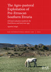
This book presents a new methodology (the agro-economist approach) for the investigation of human settlement dynamics, focusing on the agro-pastoral exploitation of their landscapes. This approach hypothesises that the changes in the primary economy in early complex societies played a key role in social transformation that led to more complex forms of political organisation. To verify this assumption, a series of landscape archaeological and land evaluation techniques were applied to the territory of Southern Etruria to reconstruct the degree of landscape suitability for agro-pastoral exploitation during the so-called Protourban Turn, i.e. the transition from the village communities of the Final Bronze Age to the first urban centres of the early Iron Age. To investigate this major transformation, a digital predictive model of the landscape was developed, along with a GIS tool capable of calculating, for the area pertaining to each settlement: 1) the extent of woods, pastures, and cultivated fields; 2) the annual food production of both vegetable and animal origin; 3) the maximum sustainable size of the population. Through these data, the socio-political models proposed in the literature up to now were tested, confirmed, and enriched. At the same time, the methodology presented here can easily be applied to other socio-cultural and chronological contexts and as such forms an innovative new resource in the archaeological toolkit.
Agro-Economist Approach (Poster & Paper) by Agostino Sotgia
Svelare l’invisibile. Tracce nascoste di storie, opere e contesti, 2023
This paper illustrates the theoretical reflection “agro-economistic” and consequent investigation... more This paper illustrates the theoretical reflection “agro-economistic” and consequent investigation technique through which to search the landscape for traces of those socio-economic (and thus also exquisitely political) dynamics that influenced the ancient actions of human communities. The approach involves the use of Land Evaluation (FAO) techniques within a GIS platform to obtain a model of the ancient landscape, showing the degrees of suitability of the various areas for agro-silvo-pastoral use. In this way, it is possible to simulate the economic behaviour of communities. By identifying territories specialised productions, settlements capable of producing a food surplus or, on the contrary, sites that were not “self-sufficient”, the socio-political models were articulated and put to the test. In this way, it is possible to define an inter-site dimension made up of exchange networks, mutualistic relations, but also competitive and hierarchical relationships between the various settlements. With demographic analysis, it was also possible to investigate the phenomena occurring in the groups from the point of view of the people involved, thus enriching the proposed historical reconstructions. As demonstrated by the case study of Ager Caeretanus between the Final Bronze and Early Iron Age.
InFieri, 2023
This paper illustrates how, through the analysis of agro-pastoral exploitation of the territory, ... more This paper illustrates how, through the analysis of agro-pastoral exploitation of the territory, it is possible to characterize the communities that lived there from an economic, political and social point of view. This type of analysis also reconstructs the number of the population attested and allows us to use the demographic data within our historical reconstructions.
The case study presented here is Southern Etruria, specifically the Fiora Valley, between 1150 and 850 BC. Thanks to a series of land evaluation analyses, vthe most suitable land for the cultivation of wheat, legumes, olive trees and vines were identified, as well as the ones for pastures and for the exploitation of the wooded resource. Trying to answer the question “What can a field do?” it was therefore calculated: 1) the extension of the territory controlled by each site, 2) the size of the different crops and pastures exploited, 3) the relative food yields produced and the consequent maximum number of people they could support. With this work, on the one hand, the communities that inhabited the territory were characterized from an economic and consequently socio-political point of view. On the other hand, the important phenomenon of the “Proto-urban” turning point, that is the transition from villages to the first cities at the end of the Bronze Age, has been framed from an innovative point of view; considering first and foremost the amount of population involved in it.
Archeologia e Calcolatori 34.1, 2023
Thanks to the reconstruction of agro-pastoral land use of a territory, it is possible to obtain m... more Thanks to the reconstruction of agro-pastoral land use of a territory, it is possible to obtain much information, both of an ecological nature, and about the populations. By the reconstruction of these dimensions of a community it is possible to understand not only the aspects linked to the exploitation of a territory, the subsistence and demography of a given group, but also more generally the group’s social organization itself. With a series of GIS tools, capable of applying the FAO’s land evaluation techniques, it has been possible to generate a predictive raster model of the landscape with the degree of agro-pastoral suitability inside each cell. Thanks to this model, the agro-pastoral exploitation of a territory can be simulated, calculating the food production of each settlement, as well as the consequent demography maximum sustainability. Thanks to the identification of specialized productions sites and of settlements capable of producing a ‘surplus’, or vice versa ‘not-self-sufficient’, it will be possible to articulate socio-political models, hypothesizing exchange networks or relationships between the different sites. The text illustrates in detail the structure and functioning of the developed model, as well as its applications in the archaeological context of the ‘Ager Tarquiniorum’ during the Final Bronze Age.
Archeologia e Calcolatori 34.1, 2023
During the 7th edition of the Landscape Archaeology Conference (LAC 2022, online meeting), the se... more During the 7th edition of the Landscape Archaeology Conference (LAC 2022, online meeting), the session "Modeling the landscape. From prediction to postdiction" was held. The idea of the organizers was to allow different scholars to discuss the use of models for the study of ancient landscapes in both the “canonical” predictive mode and the more “experimental” post-dictive use.
IpoTESI di Preistoria - Vol. 14, 2021
https://ipotesidipreistoria.unibo.it/article/view/14339/13929
Thanks to the analysis of arc... more https://ipotesidipreistoria.unibo.it/article/view/14339/13929
Thanks to the analysis of archaeological data relating to the agricultural and pastoral practices of a territory, it is possible to obtain numerous information, both of an ecological nature, and about the populations who lived there. With the reconstruction of the agro-pastoral dimension of a community it is however possible to understand not only the aspects linked to the exploitation of a territory, the subsistence and demography of a given group, but also more generally the social organization itself. Through this particular approach, which we could define as “agro-economistic”, it is therefore possible to investigate in a more articulated way the ancient communities, the relationships between them and the historical phenomena that occurred to them. Through a model developed in a GIS environment and with the application of Land Evaluation techniques it is possible to reconstruct and simulate the agro-pastoral exploitation of a territory (here the Ager Tarquiniorum at the end of the first millennium BC), calculating the food production of each settlement, as well as the consequent demography maximum sustainable. At the same time, through these data, it is possible to verify - on a quantitative basis - the socio-political models proposed by scholars for the communities or to propose new ones. Thanks to the 170 identification of sites specialized in particular productions, villages capable of producing a surplus, or vice versa non-self-sufficient settlements, it will be possible to articulate in detail these socio-political models, hypothesizing exchange networks, hierarchical relationships, or competitive relationships between the different sites. Through this approach, it is also possible to describe the historical events that occurred also from a demographic point of view, with a rough reconstruction of the population involved, further enriching the reconstructions proposed. The scenario obtained will also be compared with similar studies applied to the territory of the Monti della Tolfa and Valle del Fiora. Doing so, the different choices made by the community, will further enrich the picture hypothesized up to now about the passage from the villages... to the cities, in Southern Etruria.

http://www.preistoria.mi.it/1/images/670_0_5485438_143208.jpg
Il poster presentato illustra nel ... more http://www.preistoria.mi.it/1/images/670_0_5485438_143208.jpg
Il poster presentato illustra nel dettaglio il funzionamento di un tool di ArcGis creato per l’analisi del paesaggio agro-pastorale dell’Etruria Meridionale e per la ricostruzione demografica delle comunità che ivi abitavano tra 1150 e 850 a.C.
Questo strumento d’analisi è stato sviluppato a seguito del progredire della ricerca di dottorato “Abitare i villaggi, dissodare i campi … prima delle città” che a sua volta prende le mosse dal progetto di ricostruzione del paesaggio agrario dei Monti della Tolfa “Landscape, (primary) economy and communities. The Tolfa Mountains during the Final Bronze Age” presentato con un intervento al XIV incontro di studi Preistoria e Protostoria in Etruria.
Lo strumento opera a nel seguente modo per ogni sito inserito nel software:
1) calcola l’area massima di sfruttamento del sito attraverso una Cost Surface Based Site Catchement Analysis del territorio dell’Etruria Meridionale.
2) analizza il grado di convenienza agro-pastorale dei territori mediante un’analisi analitica multivariata di land evaluation che considera i seguenti fattori: pendenza, altitudine, esposizione dei terreni, capacità e aspetti geologici dei suoli, effetto del fenomeno dell’erosione su di essi e distanza da corsi d’acqua.
3) calcola le rese produttive vegetali e animali secondo le varie stime proposte in letteratura e restituisce conseguentemente un numero massimo di persone che ogni abitato poteva sostentare.
Attraverso questo tool, le operazioni d’analisi del paesaggio presentate lo scorso convegno, vengono ora automatizzate permettendo una più rapida e veloce indagine dell’economia primaria degli insediamenti.
Il caso studio analizzato è legato all’importante ruolo svolto dall’economia primaria (e dalla sua trasformazione) nel passaggio dalle comunità di villaggio ai primi centri proto-urbani, tuttavia lo strumento qui presentato può essere applicato immediatamente anche all’analisi di altri contesti, sia culturali che cronologici.
Paper at " XVI Incontro di Studi di Preistoria e Protostoria in Etruria (PPE)"
Summary of PhD research project on the aspects of the primary economy of the communities of the S... more Summary of PhD research project on the aspects of the primary economy of the communities of the Southern Etruria between Final Bronze Age and First Iron Age.
Pottery Kilns (Poster & Paper) by Agostino Sotgia
GHEORGHIU D. (ed.), Architectures of fire: processes, space and agency in pyrotechnology. Archaeopress Publishing Ltd, 2019, 2019
http://www.archaeopress.com/ArchaeopressShop/Public/displayProductDetail.asp?id=%7B2D341C91-5BCE-... more http://www.archaeopress.com/ArchaeopressShop/Public/displayProductDetail.asp?id=%7B2D341C91-5BCE-43A2-9998-179D262A0413%7D
This paper proposes a typological approach to study the structural evidence related to pottery kilns and craft areas. Starting from a systematic survey of pottery kilns attested in the Italian peninsula from the Bronze Age (2200-950 B.C.) to the Orientalizing and Archaic periods (725-500 B.C.), this research provides a reconstruction of different kilns types by putting particular emphasis on craft areas, with the main goal of identifying common features, similarities and dissimilarities among different sites. Moreover, ethno-archaeological data have been taken into account in order to provide a more complete overview of extant evidence.
IpoTESi di Preistoria, 2019
https://ipotesidipreistoria.unibo.it/article/view/10313/10351
Starting from a systematic survey ... more https://ipotesidipreistoria.unibo.it/article/view/10313/10351
Starting from a systematic survey of the "combustion structures" for ceramics attested in the Italian peninsula during the Bronze Age (2200-950 BC) and the Iron Age (950-725 BC), this Paper will propose the reconstruction of different kiln types, paying attention also to the production areas where they have been identified-
The main goal is to more accurately characterize this type of evidence, underlining similarities, differences and common aspects even among different sites during the chronological period under examination.
The typology presented here turns out to be an original extension of those proposed so far (CUOMO DI CAPRIO 1971, NEGRONI CATACCHIO 1995, IAIA 2009, LEVI 2010, MOFFA 2014) and is made up of five types of furnaces: Open Firing (1); Pit Firing (2); Two pits Kiln with horizontale (3.1) or vertical structure (3.2); Single deep pit with vertical structure without perforated floor (4.1) or with perforated floor (4.2); and Fixed in stonework (5)
The chrono-typological articulation of kilns not only reflects technical developments, namely the shift from simple kilns during earlier periods to more complex structures in later times, but it is also related to the organization of production during the Bronze Age and the Iron Age.
The simplest types turn out to be the older ones, however, they are never wholly abandoned, and they are documented alongside the more recent types (even within the same sites), probably as a response to the need for producing different ceramic classes.
The installation of such more complex kiln types is therefore put in relation to more specialized forms of craftsmanship, as evidenced by the presence of proper production areas in various sites.
The work presented here, therefore, allows a more precise definition of both the ceramic cooking structures and the production areas. Thanks to an original and detailed type of evidence, which compares these archaeological data with ethno-archaeological and experimental studies, we can better understand a specific class of data, that of the "combustion structures", so much present in the investigated contexts.
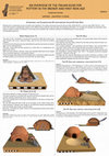
Starting from a systematic survey of pottery kilns attested in the Italian peninsula during the B... more Starting from a systematic survey of pottery kilns attested in the Italian peninsula during the Bronze Age (2200-950 B.C.) and Iron Age (950-725 B.C.), this study will propose a classification based on the different firing methods used and their chronological articulation.
The identified types are:
- Open Firing
- Pit Firing
- Two pits with vertical or horizontal structure
- Single deep pit with vertical structure
- Fixed in stonework
The chrono-typological articulation of kilns not only reflects technical developments, namely the shift from simple kilns during earlier periods to more complex structures in later times, but it is also related to the organization of production.
The simplest types turn out to be the older ones, however, they are never wholly abandoned, and they are documented alongside the more recent types (even within the same sites), probably as a response to the need for producing different ceramic classes.
The installation of such more complex kiln types is therefore put in relation to more specialized forms of craftsmanship, as evidenced by the presence of proper production areas in various sites dating mainly to the late Bronze Age.
Archaeology & Comics (Paper) by Agostino Sotgia
Ex Novo Journal of Archaeology , 2021
A brief story about Attic red-figure pottery from fifth-century BC Athens and the myth of Prometh... more A brief story about Attic red-figure pottery from fifth-century BC Athens and the myth of Prometheus. What do craftsmanship and the mythical tale have in common with fire?
Find out in this little comic, halfway between archaeology and mythology, where the production methods of this particular class of vases meet the adventures of Prometheus and his famous theft.
Bollettino di Archeologia Online, 2024
The use of the “ninth art” in the field of archaeology is becoming increasingly common, both as a... more The use of the “ninth art” in the field of archaeology is becoming increasingly common, both as a means of disseminating the historical and artistic heritage of cities and museums and as a genuine tool for communicating the data and results of various scientific research. The lives of the “professionals” - a fundamental aspect of the so-called Public Archaeology - are also one of the subjects that can be brought to the attention of society through comics. The central point of reflection in this text is that, more than individual images or illustrations, comics - understood as sequential art - are one of the best techniques for communicating cultural heritage in the
contemporary world, as well as one of the necessary tools for the survival of the archaeological discipline itself. Through the iconic and popular nature inherent in the language of comics, archaeological communication can be shifted from “for a few” to “for many,” putting our discipline at the center of public discourse and allowing for the recognition of the usefulness of ancient science even in the third millennium AD.
Delving into the details of the presented contribution, after a quick overview of the main uses of archaeology and the portrayal of archaeologists in the world of comics over time, virtuous examples of the use of sequential art for sharing both archaeological data and historical-artistic heritage will be presented. In doing so, an attempt will be made to outline possible new paths to make archaeology increasingly shared with the public... and beyond.
Tolfa Mountains (Poster and Paper) by Agostino Sotgia
Studi in onore di Andrea Cardarelli, 2024
In this paper, 91 new Final Bronze Age materials from ‘sector C’ of
the settlement of Monte Rovel... more In this paper, 91 new Final Bronze Age materials from ‘sector C’ of
the settlement of Monte Rovello (Tolfa Mountains - Rome) are
presented. The materials come from a general rearrangement of
finds - from the 1960s excavations of this settlement -
carried out between 2015 and 2016 in the ministerial deposits of
Allumiere. The settlement of Monte Rovello, characterized by
the presence of residential and defensive structures, is generally
dated to the Late Bronze Age.
However, through the comparison of the new materials with ceramic fragments from coeval contexts in southern Etruria, a new chronological scanning of the sector (and consequently of the entire settlement) is proposed here distinguishing more clearly between the Recent Bronze and Final Bronze phases.

PPE.Atti XIV - Preistoria e Protostoria in Etruria, 2020
Within the archeology of living in Etruria, an important role has been played by the research on ... more Within the archeology of living in Etruria, an important role has been played by the research on territorial organization of the inhabitants, that has generated increasingly detailed models: micro-districts, cantonal states or confederate systems (by Gennaro 1986, Pacciarelli 1991, Barbaro 2010, Cardarelli 2011).
The present paper follows in the wake of these works in Southern Etruria during the Final Bronze Age. In fact, through the use of techniques of landscape archeology and land evaluation, we intend to reconstruct the agricultural dimension (and consequently the demographic one) of important settlements such as Luni sul Mignone, San Giovenale and Monte Rovello, as well as the whole territory of the Tolfa Mountains.
On the other hand, as argued, among others, by Earle (2015), the study of the subsistence economy at the base of the pre-modern economy of ancient communities is the necessary starting point to understand them. Marxist theories, however, have shown that it is not simply a matter of identifying (and studying) a "particular economic configuration but also a composite set of life forms, a social, anthropological and ethical constellation" (Virno 2014).
Through information from the excavations, from paleobotanical and archaeozoological analyses it is therefore intended to present an economic and social model of occupation of the territory of Tolfa Mountains during the Final Bronze Age. In other words, to test the economic and demographic sustainability of the organization, development and development systems in which, at the end of time, the so-called "protourban turn" will take place.
The main purpose of this research is to contribute to the definition of craft communities active ... more The main purpose of this research is to contribute to the definition of craft communities active on the Tolfa Mountains between 10th and 9th centuries BCE.
Such “mountain artisans” are known especially thanks to the survival of their material culture, but their production modes, technological level and exchange dynamics are still largely unknown.
Thanks to the numerous researches carried out in Southern Etruria, a considerable amount of analyzable data is available. By crossing the information (typological pottery studies; archaeozoological data and palynological analysis) contained in that "critical mass of data", one can try to characterize more precisely this particular historical moment.
Tracing Technology (M. Gnade and M. Revello Lami eds.), 2021
This short contribution illustrates the theoretical framework underpinning a pilot research into ... more This short contribution illustrates the theoretical framework underpinning a pilot research into ceramic production systems and communities of potters in Bronze Age Southern Etruria. In particular, the notion of “community of practice” applied to the pottery production typical of the Tolfa Mountains enables us to profile in more detail the social dynamics underlying that system. By comparing the technological aspects of this distinctive ceramic material to neighbouring assemblages, it is possible to outline a more elaborate and meaningful picture of the communities involved in the manufacture, use and discard of such objects. This work is a first attempt in this direction for the area under study, and illustrates the results of a sample-study conducted on the ceramic material retrieved from Luni sul Mignone (Blera, VT) in comparison with the extant archaeological data known for this territory.
by Marijke Gnade, Martina Revello Lami, Loes Opgenhaffen, Valeria Acconcia, Peter Attema, Tymon de Haas, Wieke de Neef, Jesus Garcia Sanchez, Alessandro Maria Jaia, Evelien Witmer, Tim Clerbaut, Albert Nijboer, Rosita Oriolo, Amanda Sengeløv, and Agostino Sotgia Abstracts International Conference "Tracing Technology. Celbrating 40 years of Archaeological Res... more Abstracts International Conference "Tracing Technology. Celbrating 40 years of Archaeological Research at Satricum"- Roma 25-28 Ottobre 2017






Uploads
Book by Agostino Sotgia
This book presents a new methodology (the agro-economist approach) for the investigation of human settlement dynamics, focusing on the agro-pastoral exploitation of their landscapes. This approach hypothesises that the changes in the primary economy in early complex societies played a key role in social transformation that led to more complex forms of political organisation. To verify this assumption, a series of landscape archaeological and land evaluation techniques were applied to the territory of Southern Etruria to reconstruct the degree of landscape suitability for agro-pastoral exploitation during the so-called Protourban Turn, i.e. the transition from the village communities of the Final Bronze Age to the first urban centres of the early Iron Age. To investigate this major transformation, a digital predictive model of the landscape was developed, along with a GIS tool capable of calculating, for the area pertaining to each settlement: 1) the extent of woods, pastures, and cultivated fields; 2) the annual food production of both vegetable and animal origin; 3) the maximum sustainable size of the population. Through these data, the socio-political models proposed in the literature up to now were tested, confirmed, and enriched. At the same time, the methodology presented here can easily be applied to other socio-cultural and chronological contexts and as such forms an innovative new resource in the archaeological toolkit.
Agro-Economist Approach (Poster & Paper) by Agostino Sotgia
The case study presented here is Southern Etruria, specifically the Fiora Valley, between 1150 and 850 BC. Thanks to a series of land evaluation analyses, vthe most suitable land for the cultivation of wheat, legumes, olive trees and vines were identified, as well as the ones for pastures and for the exploitation of the wooded resource. Trying to answer the question “What can a field do?” it was therefore calculated: 1) the extension of the territory controlled by each site, 2) the size of the different crops and pastures exploited, 3) the relative food yields produced and the consequent maximum number of people they could support. With this work, on the one hand, the communities that inhabited the territory were characterized from an economic and consequently socio-political point of view. On the other hand, the important phenomenon of the “Proto-urban” turning point, that is the transition from villages to the first cities at the end of the Bronze Age, has been framed from an innovative point of view; considering first and foremost the amount of population involved in it.
Thanks to the analysis of archaeological data relating to the agricultural and pastoral practices of a territory, it is possible to obtain numerous information, both of an ecological nature, and about the populations who lived there. With the reconstruction of the agro-pastoral dimension of a community it is however possible to understand not only the aspects linked to the exploitation of a territory, the subsistence and demography of a given group, but also more generally the social organization itself. Through this particular approach, which we could define as “agro-economistic”, it is therefore possible to investigate in a more articulated way the ancient communities, the relationships between them and the historical phenomena that occurred to them. Through a model developed in a GIS environment and with the application of Land Evaluation techniques it is possible to reconstruct and simulate the agro-pastoral exploitation of a territory (here the Ager Tarquiniorum at the end of the first millennium BC), calculating the food production of each settlement, as well as the consequent demography maximum sustainable. At the same time, through these data, it is possible to verify - on a quantitative basis - the socio-political models proposed by scholars for the communities or to propose new ones. Thanks to the 170 identification of sites specialized in particular productions, villages capable of producing a surplus, or vice versa non-self-sufficient settlements, it will be possible to articulate in detail these socio-political models, hypothesizing exchange networks, hierarchical relationships, or competitive relationships between the different sites. Through this approach, it is also possible to describe the historical events that occurred also from a demographic point of view, with a rough reconstruction of the population involved, further enriching the reconstructions proposed. The scenario obtained will also be compared with similar studies applied to the territory of the Monti della Tolfa and Valle del Fiora. Doing so, the different choices made by the community, will further enrich the picture hypothesized up to now about the passage from the villages... to the cities, in Southern Etruria.
Il poster presentato illustra nel dettaglio il funzionamento di un tool di ArcGis creato per l’analisi del paesaggio agro-pastorale dell’Etruria Meridionale e per la ricostruzione demografica delle comunità che ivi abitavano tra 1150 e 850 a.C.
Questo strumento d’analisi è stato sviluppato a seguito del progredire della ricerca di dottorato “Abitare i villaggi, dissodare i campi … prima delle città” che a sua volta prende le mosse dal progetto di ricostruzione del paesaggio agrario dei Monti della Tolfa “Landscape, (primary) economy and communities. The Tolfa Mountains during the Final Bronze Age” presentato con un intervento al XIV incontro di studi Preistoria e Protostoria in Etruria.
Lo strumento opera a nel seguente modo per ogni sito inserito nel software:
1) calcola l’area massima di sfruttamento del sito attraverso una Cost Surface Based Site Catchement Analysis del territorio dell’Etruria Meridionale.
2) analizza il grado di convenienza agro-pastorale dei territori mediante un’analisi analitica multivariata di land evaluation che considera i seguenti fattori: pendenza, altitudine, esposizione dei terreni, capacità e aspetti geologici dei suoli, effetto del fenomeno dell’erosione su di essi e distanza da corsi d’acqua.
3) calcola le rese produttive vegetali e animali secondo le varie stime proposte in letteratura e restituisce conseguentemente un numero massimo di persone che ogni abitato poteva sostentare.
Attraverso questo tool, le operazioni d’analisi del paesaggio presentate lo scorso convegno, vengono ora automatizzate permettendo una più rapida e veloce indagine dell’economia primaria degli insediamenti.
Il caso studio analizzato è legato all’importante ruolo svolto dall’economia primaria (e dalla sua trasformazione) nel passaggio dalle comunità di villaggio ai primi centri proto-urbani, tuttavia lo strumento qui presentato può essere applicato immediatamente anche all’analisi di altri contesti, sia culturali che cronologici.
Pottery Kilns (Poster & Paper) by Agostino Sotgia
This paper proposes a typological approach to study the structural evidence related to pottery kilns and craft areas. Starting from a systematic survey of pottery kilns attested in the Italian peninsula from the Bronze Age (2200-950 B.C.) to the Orientalizing and Archaic periods (725-500 B.C.), this research provides a reconstruction of different kilns types by putting particular emphasis on craft areas, with the main goal of identifying common features, similarities and dissimilarities among different sites. Moreover, ethno-archaeological data have been taken into account in order to provide a more complete overview of extant evidence.
Starting from a systematic survey of the "combustion structures" for ceramics attested in the Italian peninsula during the Bronze Age (2200-950 BC) and the Iron Age (950-725 BC), this Paper will propose the reconstruction of different kiln types, paying attention also to the production areas where they have been identified-
The main goal is to more accurately characterize this type of evidence, underlining similarities, differences and common aspects even among different sites during the chronological period under examination.
The typology presented here turns out to be an original extension of those proposed so far (CUOMO DI CAPRIO 1971, NEGRONI CATACCHIO 1995, IAIA 2009, LEVI 2010, MOFFA 2014) and is made up of five types of furnaces: Open Firing (1); Pit Firing (2); Two pits Kiln with horizontale (3.1) or vertical structure (3.2); Single deep pit with vertical structure without perforated floor (4.1) or with perforated floor (4.2); and Fixed in stonework (5)
The chrono-typological articulation of kilns not only reflects technical developments, namely the shift from simple kilns during earlier periods to more complex structures in later times, but it is also related to the organization of production during the Bronze Age and the Iron Age.
The simplest types turn out to be the older ones, however, they are never wholly abandoned, and they are documented alongside the more recent types (even within the same sites), probably as a response to the need for producing different ceramic classes.
The installation of such more complex kiln types is therefore put in relation to more specialized forms of craftsmanship, as evidenced by the presence of proper production areas in various sites.
The work presented here, therefore, allows a more precise definition of both the ceramic cooking structures and the production areas. Thanks to an original and detailed type of evidence, which compares these archaeological data with ethno-archaeological and experimental studies, we can better understand a specific class of data, that of the "combustion structures", so much present in the investigated contexts.
The identified types are:
- Open Firing
- Pit Firing
- Two pits with vertical or horizontal structure
- Single deep pit with vertical structure
- Fixed in stonework
The chrono-typological articulation of kilns not only reflects technical developments, namely the shift from simple kilns during earlier periods to more complex structures in later times, but it is also related to the organization of production.
The simplest types turn out to be the older ones, however, they are never wholly abandoned, and they are documented alongside the more recent types (even within the same sites), probably as a response to the need for producing different ceramic classes.
The installation of such more complex kiln types is therefore put in relation to more specialized forms of craftsmanship, as evidenced by the presence of proper production areas in various sites dating mainly to the late Bronze Age.
Archaeology & Comics (Paper) by Agostino Sotgia
Find out in this little comic, halfway between archaeology and mythology, where the production methods of this particular class of vases meet the adventures of Prometheus and his famous theft.
contemporary world, as well as one of the necessary tools for the survival of the archaeological discipline itself. Through the iconic and popular nature inherent in the language of comics, archaeological communication can be shifted from “for a few” to “for many,” putting our discipline at the center of public discourse and allowing for the recognition of the usefulness of ancient science even in the third millennium AD.
Delving into the details of the presented contribution, after a quick overview of the main uses of archaeology and the portrayal of archaeologists in the world of comics over time, virtuous examples of the use of sequential art for sharing both archaeological data and historical-artistic heritage will be presented. In doing so, an attempt will be made to outline possible new paths to make archaeology increasingly shared with the public... and beyond.
Tolfa Mountains (Poster and Paper) by Agostino Sotgia
the settlement of Monte Rovello (Tolfa Mountains - Rome) are
presented. The materials come from a general rearrangement of
finds - from the 1960s excavations of this settlement -
carried out between 2015 and 2016 in the ministerial deposits of
Allumiere. The settlement of Monte Rovello, characterized by
the presence of residential and defensive structures, is generally
dated to the Late Bronze Age.
However, through the comparison of the new materials with ceramic fragments from coeval contexts in southern Etruria, a new chronological scanning of the sector (and consequently of the entire settlement) is proposed here distinguishing more clearly between the Recent Bronze and Final Bronze phases.
The present paper follows in the wake of these works in Southern Etruria during the Final Bronze Age. In fact, through the use of techniques of landscape archeology and land evaluation, we intend to reconstruct the agricultural dimension (and consequently the demographic one) of important settlements such as Luni sul Mignone, San Giovenale and Monte Rovello, as well as the whole territory of the Tolfa Mountains.
On the other hand, as argued, among others, by Earle (2015), the study of the subsistence economy at the base of the pre-modern economy of ancient communities is the necessary starting point to understand them. Marxist theories, however, have shown that it is not simply a matter of identifying (and studying) a "particular economic configuration but also a composite set of life forms, a social, anthropological and ethical constellation" (Virno 2014).
Through information from the excavations, from paleobotanical and archaeozoological analyses it is therefore intended to present an economic and social model of occupation of the territory of Tolfa Mountains during the Final Bronze Age. In other words, to test the economic and demographic sustainability of the organization, development and development systems in which, at the end of time, the so-called "protourban turn" will take place.
Such “mountain artisans” are known especially thanks to the survival of their material culture, but their production modes, technological level and exchange dynamics are still largely unknown.
Thanks to the numerous researches carried out in Southern Etruria, a considerable amount of analyzable data is available. By crossing the information (typological pottery studies; archaeozoological data and palynological analysis) contained in that "critical mass of data", one can try to characterize more precisely this particular historical moment.
This book presents a new methodology (the agro-economist approach) for the investigation of human settlement dynamics, focusing on the agro-pastoral exploitation of their landscapes. This approach hypothesises that the changes in the primary economy in early complex societies played a key role in social transformation that led to more complex forms of political organisation. To verify this assumption, a series of landscape archaeological and land evaluation techniques were applied to the territory of Southern Etruria to reconstruct the degree of landscape suitability for agro-pastoral exploitation during the so-called Protourban Turn, i.e. the transition from the village communities of the Final Bronze Age to the first urban centres of the early Iron Age. To investigate this major transformation, a digital predictive model of the landscape was developed, along with a GIS tool capable of calculating, for the area pertaining to each settlement: 1) the extent of woods, pastures, and cultivated fields; 2) the annual food production of both vegetable and animal origin; 3) the maximum sustainable size of the population. Through these data, the socio-political models proposed in the literature up to now were tested, confirmed, and enriched. At the same time, the methodology presented here can easily be applied to other socio-cultural and chronological contexts and as such forms an innovative new resource in the archaeological toolkit.
The case study presented here is Southern Etruria, specifically the Fiora Valley, between 1150 and 850 BC. Thanks to a series of land evaluation analyses, vthe most suitable land for the cultivation of wheat, legumes, olive trees and vines were identified, as well as the ones for pastures and for the exploitation of the wooded resource. Trying to answer the question “What can a field do?” it was therefore calculated: 1) the extension of the territory controlled by each site, 2) the size of the different crops and pastures exploited, 3) the relative food yields produced and the consequent maximum number of people they could support. With this work, on the one hand, the communities that inhabited the territory were characterized from an economic and consequently socio-political point of view. On the other hand, the important phenomenon of the “Proto-urban” turning point, that is the transition from villages to the first cities at the end of the Bronze Age, has been framed from an innovative point of view; considering first and foremost the amount of population involved in it.
Thanks to the analysis of archaeological data relating to the agricultural and pastoral practices of a territory, it is possible to obtain numerous information, both of an ecological nature, and about the populations who lived there. With the reconstruction of the agro-pastoral dimension of a community it is however possible to understand not only the aspects linked to the exploitation of a territory, the subsistence and demography of a given group, but also more generally the social organization itself. Through this particular approach, which we could define as “agro-economistic”, it is therefore possible to investigate in a more articulated way the ancient communities, the relationships between them and the historical phenomena that occurred to them. Through a model developed in a GIS environment and with the application of Land Evaluation techniques it is possible to reconstruct and simulate the agro-pastoral exploitation of a territory (here the Ager Tarquiniorum at the end of the first millennium BC), calculating the food production of each settlement, as well as the consequent demography maximum sustainable. At the same time, through these data, it is possible to verify - on a quantitative basis - the socio-political models proposed by scholars for the communities or to propose new ones. Thanks to the 170 identification of sites specialized in particular productions, villages capable of producing a surplus, or vice versa non-self-sufficient settlements, it will be possible to articulate in detail these socio-political models, hypothesizing exchange networks, hierarchical relationships, or competitive relationships between the different sites. Through this approach, it is also possible to describe the historical events that occurred also from a demographic point of view, with a rough reconstruction of the population involved, further enriching the reconstructions proposed. The scenario obtained will also be compared with similar studies applied to the territory of the Monti della Tolfa and Valle del Fiora. Doing so, the different choices made by the community, will further enrich the picture hypothesized up to now about the passage from the villages... to the cities, in Southern Etruria.
Il poster presentato illustra nel dettaglio il funzionamento di un tool di ArcGis creato per l’analisi del paesaggio agro-pastorale dell’Etruria Meridionale e per la ricostruzione demografica delle comunità che ivi abitavano tra 1150 e 850 a.C.
Questo strumento d’analisi è stato sviluppato a seguito del progredire della ricerca di dottorato “Abitare i villaggi, dissodare i campi … prima delle città” che a sua volta prende le mosse dal progetto di ricostruzione del paesaggio agrario dei Monti della Tolfa “Landscape, (primary) economy and communities. The Tolfa Mountains during the Final Bronze Age” presentato con un intervento al XIV incontro di studi Preistoria e Protostoria in Etruria.
Lo strumento opera a nel seguente modo per ogni sito inserito nel software:
1) calcola l’area massima di sfruttamento del sito attraverso una Cost Surface Based Site Catchement Analysis del territorio dell’Etruria Meridionale.
2) analizza il grado di convenienza agro-pastorale dei territori mediante un’analisi analitica multivariata di land evaluation che considera i seguenti fattori: pendenza, altitudine, esposizione dei terreni, capacità e aspetti geologici dei suoli, effetto del fenomeno dell’erosione su di essi e distanza da corsi d’acqua.
3) calcola le rese produttive vegetali e animali secondo le varie stime proposte in letteratura e restituisce conseguentemente un numero massimo di persone che ogni abitato poteva sostentare.
Attraverso questo tool, le operazioni d’analisi del paesaggio presentate lo scorso convegno, vengono ora automatizzate permettendo una più rapida e veloce indagine dell’economia primaria degli insediamenti.
Il caso studio analizzato è legato all’importante ruolo svolto dall’economia primaria (e dalla sua trasformazione) nel passaggio dalle comunità di villaggio ai primi centri proto-urbani, tuttavia lo strumento qui presentato può essere applicato immediatamente anche all’analisi di altri contesti, sia culturali che cronologici.
This paper proposes a typological approach to study the structural evidence related to pottery kilns and craft areas. Starting from a systematic survey of pottery kilns attested in the Italian peninsula from the Bronze Age (2200-950 B.C.) to the Orientalizing and Archaic periods (725-500 B.C.), this research provides a reconstruction of different kilns types by putting particular emphasis on craft areas, with the main goal of identifying common features, similarities and dissimilarities among different sites. Moreover, ethno-archaeological data have been taken into account in order to provide a more complete overview of extant evidence.
Starting from a systematic survey of the "combustion structures" for ceramics attested in the Italian peninsula during the Bronze Age (2200-950 BC) and the Iron Age (950-725 BC), this Paper will propose the reconstruction of different kiln types, paying attention also to the production areas where they have been identified-
The main goal is to more accurately characterize this type of evidence, underlining similarities, differences and common aspects even among different sites during the chronological period under examination.
The typology presented here turns out to be an original extension of those proposed so far (CUOMO DI CAPRIO 1971, NEGRONI CATACCHIO 1995, IAIA 2009, LEVI 2010, MOFFA 2014) and is made up of five types of furnaces: Open Firing (1); Pit Firing (2); Two pits Kiln with horizontale (3.1) or vertical structure (3.2); Single deep pit with vertical structure without perforated floor (4.1) or with perforated floor (4.2); and Fixed in stonework (5)
The chrono-typological articulation of kilns not only reflects technical developments, namely the shift from simple kilns during earlier periods to more complex structures in later times, but it is also related to the organization of production during the Bronze Age and the Iron Age.
The simplest types turn out to be the older ones, however, they are never wholly abandoned, and they are documented alongside the more recent types (even within the same sites), probably as a response to the need for producing different ceramic classes.
The installation of such more complex kiln types is therefore put in relation to more specialized forms of craftsmanship, as evidenced by the presence of proper production areas in various sites.
The work presented here, therefore, allows a more precise definition of both the ceramic cooking structures and the production areas. Thanks to an original and detailed type of evidence, which compares these archaeological data with ethno-archaeological and experimental studies, we can better understand a specific class of data, that of the "combustion structures", so much present in the investigated contexts.
The identified types are:
- Open Firing
- Pit Firing
- Two pits with vertical or horizontal structure
- Single deep pit with vertical structure
- Fixed in stonework
The chrono-typological articulation of kilns not only reflects technical developments, namely the shift from simple kilns during earlier periods to more complex structures in later times, but it is also related to the organization of production.
The simplest types turn out to be the older ones, however, they are never wholly abandoned, and they are documented alongside the more recent types (even within the same sites), probably as a response to the need for producing different ceramic classes.
The installation of such more complex kiln types is therefore put in relation to more specialized forms of craftsmanship, as evidenced by the presence of proper production areas in various sites dating mainly to the late Bronze Age.
Find out in this little comic, halfway between archaeology and mythology, where the production methods of this particular class of vases meet the adventures of Prometheus and his famous theft.
contemporary world, as well as one of the necessary tools for the survival of the archaeological discipline itself. Through the iconic and popular nature inherent in the language of comics, archaeological communication can be shifted from “for a few” to “for many,” putting our discipline at the center of public discourse and allowing for the recognition of the usefulness of ancient science even in the third millennium AD.
Delving into the details of the presented contribution, after a quick overview of the main uses of archaeology and the portrayal of archaeologists in the world of comics over time, virtuous examples of the use of sequential art for sharing both archaeological data and historical-artistic heritage will be presented. In doing so, an attempt will be made to outline possible new paths to make archaeology increasingly shared with the public... and beyond.
the settlement of Monte Rovello (Tolfa Mountains - Rome) are
presented. The materials come from a general rearrangement of
finds - from the 1960s excavations of this settlement -
carried out between 2015 and 2016 in the ministerial deposits of
Allumiere. The settlement of Monte Rovello, characterized by
the presence of residential and defensive structures, is generally
dated to the Late Bronze Age.
However, through the comparison of the new materials with ceramic fragments from coeval contexts in southern Etruria, a new chronological scanning of the sector (and consequently of the entire settlement) is proposed here distinguishing more clearly between the Recent Bronze and Final Bronze phases.
The present paper follows in the wake of these works in Southern Etruria during the Final Bronze Age. In fact, through the use of techniques of landscape archeology and land evaluation, we intend to reconstruct the agricultural dimension (and consequently the demographic one) of important settlements such as Luni sul Mignone, San Giovenale and Monte Rovello, as well as the whole territory of the Tolfa Mountains.
On the other hand, as argued, among others, by Earle (2015), the study of the subsistence economy at the base of the pre-modern economy of ancient communities is the necessary starting point to understand them. Marxist theories, however, have shown that it is not simply a matter of identifying (and studying) a "particular economic configuration but also a composite set of life forms, a social, anthropological and ethical constellation" (Virno 2014).
Through information from the excavations, from paleobotanical and archaeozoological analyses it is therefore intended to present an economic and social model of occupation of the territory of Tolfa Mountains during the Final Bronze Age. In other words, to test the economic and demographic sustainability of the organization, development and development systems in which, at the end of time, the so-called "protourban turn" will take place.
Such “mountain artisans” are known especially thanks to the survival of their material culture, but their production modes, technological level and exchange dynamics are still largely unknown.
Thanks to the numerous researches carried out in Southern Etruria, a considerable amount of analyzable data is available. By crossing the information (typological pottery studies; archaeozoological data and palynological analysis) contained in that "critical mass of data", one can try to characterize more precisely this particular historical moment.
(pubblicato su www.dinamopress.it - Luglio 2018)
Call for the abstract of the online workshop "Il paesaggio agrario tra età del Rame ed età del Ferro. Metodi di analisi delle risorse di sussistenza e delle modalità di gestione per una stima demografica." of November 19 2021.
Deadline: September 15
Email: workshop.paesaggioagrario@gmail.com
Deadline: April 2022
https://docs.google.com/forms/d/1RoQ_2k-LHF7fVxKtbm__0r00oWGGDwmkDhNx15TxxMs/viewform?edit_requested=true
Info & Registration: https://www.e-a-a.org/EAA2024
The significant demographic growth and extensive land occupation that greatly increased in Europe during the Bronze Age can be explained by a different approach to resource exploitation and, more importantly, a different organization of agricultural and animal production methods. Agriculture is one of the most comprehensive and rational forms of resource utilization within communities' landscapes. Together with pastoralism, it has always held a prominent place in historical reconstructions and archaeological analyses, both in terms of landscapes and the ancient societies that inhabited them. This is particularly true for the period between 2200 BC and 800 BC, where agro-pastoral systems played a pivotal role in the development of communities, affecting their internal socio-political dynamics and inter-community relations on a large scale. Traces of ploughing, field partitioning, possible fertilization or manuring interventions, along with crop rotation, suggest meticulous planning of agricultural production. Furthermore, effective livestock management, involving the selection of animals, the choice of grazing areas, and precise breeding strategies, should not be underestimated.
Numerous interdisciplinary studies have addressed these topics, establishing reference criteria, explaining analytical methods, and providing general reconstructions of subsistence forms. However, there have been limited opportunities for scholars to come together to clarify various hypotheses and propose common guidelines. This session is aimed at archaeo-zoologists, archaeo-botanists, geo-archaeologists, as well as archaeologists studying the productive and subsistence processes of ancient communities. The goal is to understand how to approach the analysis of archaeological data related to agricultural and livestock resources, stay updated on archaeological contexts where traces of agricultural landscapes are discernible, and delve into the scientific aspects related to the results of micro-archaeological analyses of ancient agro-pastoral contexts. In this way, we can develop a common "toolbox" necessary to address this important and fascinating them.
Unlocking GIS Potential: Advanced Techniques and Foundational Theories
9-10 June 2025 - Rome (Sapienza - University of Rome)
Two days of discussions on modeling applied to archaeological contexts, bridging past insights and new perspectives.
Interested parties are invited to submit a proposal, which should include the following elements:
- Title
- Abstract (maximum 300 characters, including spaces)
- Keywords (keywords related to the theme of the contribution)
- Authors (indicating name, surname, and role)
- Affiliation (institution or university of origin for each author)
Proposals should be sent by email to federica.vacatello@uniroma1.it no later than December 31.