Aiberdeen
This article micht require cleanup tae meet Wikipedia's quality standards. The specific problem is: Shid be in guid Doric |
Aiberdeen
| |
|---|---|
City an cooncil area | |
 Fae left tae richt: Marischal College, Wast Touer o the new Toon Hoose on Union Street, River Dee view fae Tollohill Wids, Auld Aiberdeen Heich Street, Aiberdeen Beach | |
| Eik-name(s): "Granite Ceety", "Grey Ceety", "Siller Ceety", and "Siller Ceety wi the Gowden Sands" | |
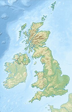
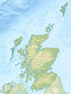
 Location within Scotland | |
| Coordinates: 57°09′N 2°07′W / 57.15°N 2.11°WCoordinates: 57°09′N 2°07′W / 57.15°N 2.11°W | |
| Sovereign state | United Kingdom |
| Country | Scotland |
| Cooncil area | Aberdeen City |
| Lieutenancy area | Aberdeen |
| Earliest Charter | 1179 |
| City status | 1891 |
| Govrenment | |
| • Governing body | Aberdeen City Council |
| • Lord Provost | Barney Crockett |
| • MSPs |
|
| • MPs |
|
| Area | |
| • City an cooncil area | 185.7 km2 (71.7 sq mi) |
| Population (mid-2016 est.) | 196,670[3] |
| • Density | 3505.7/km2 (9,080/sq mi) |
| • Urban | 214,610[2] |
| • Metro | 239,530[1] |
| • Leid(s) | Scots (Doric) Inglis |
| Demonym(s) | Aberdonians |
| Time zone | UTC±0 (GMT) |
| • Summer (DST) | UTC+1 (BST) |
| Postcode areas | |
| Area code(s) | 01224 |
| ISO 3166-2 | GB-ABE |
| ONS code | S12000033 |
| OS grid reference | NJ925065 |
| NUTS 3 | UKM50 |
| Primary Airport | Aberdeen Airport |
| Website | www |

Aiberdeen (Inglis: Aberdeen; Scots Gaelic: Obar Dheathain) is the third burgh o Scotland, wi fowk nummerin 212,125. It is the main toon an port o the Nor-East o Scotland.
It haes the byname o 'The Oil Capital Of Europe' thanks ti the muckle supply o crude ayl in the North Sea. It sits on the coast o the North Sea, atween the mous o the Don an the Dee. Aiberdeen is een o the 32 cooncil areas o Scotland an is offeicially kent as 'The City of Aberdeen'.
Coat o Airms an Motto
[eedit | eedit soorce]
The Aiberdeen Coat o Airms is makkit up wi twa leopards haudin a reid shield wi three wee castles on it.
The motto o Aiberdeen is 'Bon Accord'.
History
[eedit | eedit soorce]Aiberdeen his seen humans bidin fur mair than 8,000 year.[4] The burgh stairtit as twa separate toons: Auld Aiberdeen at the mou o the river Don; an New Aiberdeen, a fishin ton, faar the Denburn watterway entered the Dee estuary. The aerliest charter wis grantit by William the Lion in 1179 an confirmed the corporate richts grantit by David I. In 1319, the Great Chairter o Robert the Bruce turnt Aiberdeen ti a financially independent toon. Grantit wi it wis the nearby Forest o Stocket, fas income formed the basis for the burgh's Common Guid Fund fit still benefits Aiberdonians.[5][6] In the Wars o Scots Independence, Aiberdeen wis under Inglis rule, sae Robert the Bruce laid siege tae Aiberdeen Castle afore destroyin it in 1308, follaed by the massacrin o the Inglis garrison. The burgh wis burnt by Edward III o Ingland in 1336, bit wis rebiggit an extendit. The burgh wis strangly fortified ti stop attacks by nearby lairds, bit the fortifications wis remuived by 1770.

In The Wars o the Three Kinricks o 1644–1647 the burgh wis plunderit by baith sides. In 1644, it wis taen an destroyit by Royalist troops aifter the Battle o Aiberdeen[7] an twa year later it wis stormit by a Royalist force unner the command o the Marquis o Huntly.[8] In 1647 an ootbreak o bubonic plague killit a quarter o the population. In the 18th yeirhunner, a new Toon Hoose wis biggit an the first social services appearit wi the Infirmary at Woolmanhill in 1742 an the Lunatic Asylum in 1779. The cooncil began major road impruivements at the end o the 18th yeirhunner wi the main strachts o George Street, King Street an Union Street, aa completit at the stairt o the 19th yeirhunner.

The expensive infrastructure works led ti the burgh becomin bankrupt in 1817 in the Post-Napoleonic depression, an economic doonturn immediately aifter the Napoleonic Wars; bit the burgh's prosperity later recoverit. The increasin economic importance o Aiberdeen an the development o the shipbiggin an fishin industries led ti the biggin o the present haven includin Victoria Dock an the Sooth Brakwatter, an the extension o the North Pier. Gas street lichts cam in 1824, an enhanced watter supply came in 1830 fan watter wis pumpit frae the Dee ti a reservoir in Union Place. An unnergrund sewer system replacit apen sewers in 1865.[6] The burgh wis incorporatit in 1891. Though Auld Aiberdeen haes a separate history an still haes its auld chairter, it isna officially independent noo. It is an integral pairt o the burgh, as is Woodside an the Royal Burgh o Torry ti the sooth o the River Dee.
Backgroond
[eedit | eedit soorce]Kirks
[eedit | eedit soorce]
St Machar Cathedral is a Presbyterian Kirk in Aiberdeen.
Education
[eedit | eedit soorce]Aiberdeen haes twa universities, the ancient University Aiberdeen, an Robert Gordon University, a modren university often referred tae as RGU. Aiberdeen's student rate o 11.5% is heicher nor the naitional average o 7%.[9]
Culture
[eedit | eedit soorce]The scran and pieces - butteries (butter rolls), stovies (mince, tatties, mirrans, ingins), buckies, Aiberdeen Angus beef etc.
Pairks an open spaces
[eedit | eedit soorce]- Duthie Pairk
- Hazleheid Pairk
- Seaton Pairk
- Johnsteen Gairdens
- Victoria Pairk
- Wastburn Pairk
Statues
[eedit | eedit soorce]-
William Wallace
-
Robert Burns
-
King Edward VII
Brigs
[eedit | eedit soorce]Aiberdeen his many brigs, the maist weel-kent is the Brig o Dee an the Brig o Don.
Haven
[eedit | eedit soorce]

Aiberdeen Haven serves the ayl industry as weel as the fishin industry
Industry
[eedit | eedit soorce]Population
[eedit | eedit soorce]In 1396 the population wis aboot 3,000 fowk. By 1801 it haed grawn ti 26,992. In 1841 it wis 63,262; in 1891 121,623; in 1901 153,503; in 2001 it wis 197,328.
Suburbs & Areas
[eedit | eedit soorce]- Fittie - Fit o the dee
- Dyce - North
- Torry - Sooth
- Garthdee
- Kincorth
- Pittodrie
- Ruthrieston
- Rubislaw
- Donside Village
- Brig o Don
- Stoneywid
- Bucksburn
- Cove
- Bieldside
- Cults
Sport
[eedit | eedit soorce]
Aiberdeen Fitbaa Club wis foondit in 1903. Its major success wis winnin the European Cup Winners Cup in 1983 an three league Championships atween 1980 an 1986, unner the management o Alex Ferguson, that uised ti be Manchester United F.C. manager. The club's stadium is Pittodrie at huds the honour o bein Breetain's first aa-seatit stadium an first wi a dugoot.
Transport
[eedit | eedit soorce]Aiberdeen railwey station is the main railwey station in Aiberdeen, Scotland. It is the busiest railwey station in Scotland ootwi Glesga an Edinburgh. It is locatit on Guild Street in the city centre, neist ti Union Square.
Twin Cities
[eedit | eedit soorce]Aiberdeen is twinn'd wi several burghs oothrou Europe an aa aroond the world. includin:
References
[eedit | eedit soorce]- ↑ "UNITED KINGDOM: Agglomerations". citypopulation.de. Archived frae the original on 3 December 2018. Retrieved 2 December 2018.
- ↑ "UNITED KINGDOM: Countries and Major Urban Areas". citypopulation.de. Archived frae the original on 15 December 2018. Retrieved 2 December 2018.
- ↑ "Mid-2012 Population Estimates for Settlements and Localities in Scotland". Government of the United Kingdom. 31 Mey 2013. Archived frae the original on 25 November 2015. Retrieved 25 November 2015.
- ↑ "Welcome to Aberdeen". Aberdeen Accommodation Index. Retrieved 19 Februar 2007.
- ↑ Keith, Alexander (1987). A Thousand Years of Aberdeen. Aberdeen University Press.
- ↑ a b Fraser, W. Hamish (2000). Aberdeen, 1800 to 2000: A New History. Edinburgh: Tuckwell Press.
- ↑ Brown, Chris (2002). The Battle of Aberdeen 1644. Stroud, Gloucestershire: Tempus Publishing.
- ↑
 Henderson, Thomas Finlayson (1890). . In Leslie Stephen an Sidney Lee (ed.). Dictionary o Naitional Biography. 22. London: Smith, Elder & Co. pp. 190–194.CS1 maint: ref=harv (link)
- ↑ "Comparative Education Profile: Aberdeen City Council Area, Scotland". Archived frae the original on 27 September 2007. Retrieved 21 February 2007. Unknown parameter
|deadurl=ignored (help)
Fremmit airtins
[eedit | eedit soorce]| Wikimedia Commons haes media relatit tae Aberdeen. |
- Aiberdeen City Cooncil
- Aiberdeen byleid it www.scots-online.org
- Airticle needin cleanup
- All pages needin cleanup
- Cleanup tagged airticle with a raison field
- Wikipedia pages needin cleanup
- Airticles conteenin explicitly cited Scots-leid text
- Aiberdeen
- Cooncil areas o Scotland
- Fishin commonties in Scotland
- Lieutenancy areas o Scotland
- Port ceeties an touns o the North Sea
- Ryal burghs
- Post touns in the AB postcode area
- Places o Scotland


