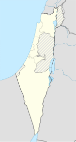
Majd al-Krum
Majd al-Krum
| |
|---|---|
| Hebrew transcription(s) | |
| • Forby spelt | Majd al-Kurum (offeecial) |
| Coordinates: 32°55′17″N 35°15′25″E / 32.92139°N 35.25694°ECoordinates: 32°55′17″N 35°15′25″E / 32.92139°N 35.25694°E | |
| Destrict | Northren |
| Govrenment | |
| • Teep | (frae 1964) |
| Area | |
| • Total | 5.4 km2 (2.1 sq mi) |
| Population (2009) | |
| • Total | 13,500 |
| • Density | 2,500/km2 (6,500/sq mi) |
| Name meanin | "Vineyard o Glory" |
Majd al-Krum (Arabic: مجد الكروم, Hebrew: מַגְ'ד אל-כֻּרוּם Majd al-Kurum) is an Arab toun locatit in the Upper Galilee in Israel's North Destrict aboot 16 kilometer (10 mile) east o Acre. The name o the veelage translates tae "Vineyard o Glory,"[1] reflectin the toun's fame for the quality o its grape vines.[2] The toun is entirely inhabitit bi Muslims. In 2009 it haed a population o roughly 13,500.[3]
History
[eedit | eedit soorce]Majd al-Krum's name probably comes frae the "watch-hoose o the vineyard" in Arabic.[4] Majd al-Kurum receives it name for its history o growin grapes. Auncient ruins (locatit on the ootskirts o the toun), consistin o pits biggit intae the rocks whare the residents uised thair feet tae press thair grape crop tae mak wine.
In 1596 Majd al-Krum appeared in Ottoman tax registers as bein in the Nahiya o Akka o the Liwa o Safad. It haed a population o 90 Muslim hoosehaulds includin five bachelors an paid taxes on wheat, barley, olives or fruit trees, cotton, an goats or beehives.[5] In the late 19t century, it wis describit as a veelage biggit o stane an surroondit bi olive trees an arable land. It wis inhabitit bi 600–800 Muslims.[6]
At the time o the 1931 census, Majd al-Krum haed 226 occupee'd hooses an a population o 1,006 Muslims.[7] Bi 1945, Majd al-Kurum haed 1,400 indwallers, aw classifee'd as Arabs. Thay awned a tot o 17,828 dunams o land, while 2214 dunams wur public property.[8]
Majd al-Krum wis captured bi Israeli forces in October 1948. In the 1960s Israel confiscatit a lairge percentage o land frae Majd al-Krum tae form the ceety o Karmiel. The toun wis made a local cooncil in 1964.[1] On the ootskirts o toun ane can see auncient ruins consistin o pits biggit intae the rocks whare the auncient residents uised thair feet tae press thair grape crop tae mak wine.
In 2003 Majd al-Krum alang wi the nearbi local cooncils o Deir al-Asad an Bi'ina mergit tae form the ceety o Shaghur.[1] Durin the 2006 Lebanon War, ower 40 Katyusha rockets landit in the vicinity o Shaghur, wi the nearbi ceety o Karmiel bein the apparent target. Twa men frae Majd al-Krum, Baha' Karim an Muhammad Subhi Mana', wur killed when a rocket struck near them.[9] Shaghur wis later dissolvit in 2009.[3]
References
[eedit | eedit soorce]- ↑ a b c Gutterman, Dov. Local Council of Majd el-Kurum (Israel) Archived 2016-03-03 at the Wayback Machine. Flags of th World.
- ↑ Asser, Martin. Inside a Palestinian refugee camp. BBC News. 2008-05-17.
- ↑ a b Table 1 - Population of Localities Numbering Above 2,500 Residents. Israel Central Bureau of Statistics (ICBS). 2009.
- ↑ Palmer, 1881, p. 52
- ↑ Wolf-Dieter Hütteroth and Kamal Abdulfattah (1977). Historical Geography of Palestine, Transjordan and Southern Syria in the Late 16th Century. Erlanger Geographische Arbeiten, Sonderband 5. Erlangen, Germany: Vorstand der Fränkischen Geographischen Gesellschaft. p. 191.
- ↑ Conder an Kitchener, 1881, SWP, p. 150
- ↑ E. Mills, ed. (1932). Census of Palestine 1931. Population of Villages, Towns and Administrative Areas. Jerusalem: Government of Palestine. pp. 100–101.
- ↑ Government of Palestine, Department of Statistics. Village Statistics, April, 1945. Quoted in S. Hadawi, Village Statistics, 1945. PLO Research Center, 1970 p.40
- ↑ Civilians under assault, Case Studies: Karmiel, Majd al-Kurum and Deir al-Assad Human Rights Watch. August 2007.
Bibliography
[eedit | eedit soorce]- Conder, Claude Reignier an H.H. Kitchener (1881): The Survey of Western Palestine: memoirs of the topography, orography, hydrography, and archaeology. Lunnon:Committee o the Palestine Exploration Fund. vol 1, cairt III
- Ellenblum, Ronnie (2003), Frankish Rural Settlement in the Latin Kingdom of Jerusalem, Cambridge University Press, ISBN 9780521521871 freemit airtin in
|title=(help) pp. 167- 169 - Hadawi, Sami (1970), Village Statistics of 1945: A Classification of Land and Area ownership in Palestine, Palestine Liberation Organization Research Center

