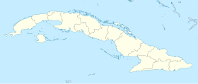
Martí, Cuba
Martí | |
|---|---|
Location o Martí in Cuba | |
| Coordinates: 22°57′8″N 80°55′0″W / 22.95222°N 80.91667°W | |
| Kintra | |
| Province | Matanzas |
| Foundit | 1835 (Hato Nuevo)[1] |
| Established | 1879 |
| Area | |
| • Total | 1070 km2 (410 sq mi) |
| Elevation | 20 m (70 ft) |
| Population (2004)[3] | |
| • Total | 23,475 |
| • Density | 21.9/km2 (57/sq mi) |
| Time zone | UTC-5 (EST) |
| Area code(s) | +53-56 |
Martí is a toun an municipality in north-eastren section o Cuba's Matanzas Province.
Geografie
[eedit | eedit soorce]The municipality is dividit intae the barrios o Guamutas, Lacret, La Teja, Martí, Máximo Gómez, Motembo an Río de la Palma.[1]
It is locatit on the north-central coast o Cuba, an includes the lagoons Inglés, Bibanasí an Majagüillar, aw extensions o the Bay o Santa Clara (Bahia de Santa Clara). Its territory is crossed bi the rivers La Palma, Júcaro an San Manuel.
History
[eedit | eedit soorce]The toun wis foondit in 1835 unner the name Hato Nuevo[1] on the location o the Bibanosí ranch. On 24 December 1898 the name wis chyngit tae Martí, in honour o unthirldom hero José Martí.
Demografics
[eedit | eedit soorce]In 2004, the municipality o Martí haed a population o 23,475.[3] Wi a total area o 1,070 km2 (410 sq mi),[2] it haes a population densitie o 21.9/km2 (57/sq mi).
See an aw
[eedit | eedit soorce]References
[eedit | eedit soorce]- ↑ a b c Guije.com. "Martí". Retrieved 7 October 2007. (in Spaingie)
- ↑ a b Statoids (2003). "Municipios of Cuba". Retrieved 7 October 2007. Unknown parameter
|month=ignored (help) - ↑ a b Atenas.cu (2004). "2004 Population trends, by Province and Municipality". Archived frae the original on 27 September 2007. Retrieved 7 October 2007. (in Spaingie)
