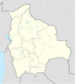
Oruro, Bolivie
Oruro | |
|---|---|
 | |
| Coordinates: 17°58′S 67°07′W / 17.967°S 67.117°W | |
| Kintra | |
| Depairtment | Oruro Depairtment |
| Province | Cercado Province |
| Foondit | 1 November 1606 |
| Govrenment | |
| • Mayor | Rossío Pimentel |
| Elevation | 3706 m (12159 ft) |
| Population | |
| • Total | 235,393 |
| 2010 calculation | |
| Time zone | UTC-4 |
| Website | http://www.preforuro.gov.bo/ |
Oruro is a ceety in Bolivie wi a population o 235,393 (2010 calculation)[1], locatit aboot equidistant atween La Paz an Sucre at approximately 3710 meters abuin sea level. It is the caipital o the depairtment o Oruro. The ceety wis named efter the native tribe "Uru-Uru".
History
[eedit | eedit soorce]The ceety wis first foondit on November 1, 1606 bi Don Manuel Castro de Padilla. as a siller minin centre in the Urus region. At the time, it wis named Real Villa de San Felipe de Austria efter the Spainyie monarch, Philip III. It wis eventually abandoned as the siller mines became exhausted. Oruro wis reestablished in the late nineteent century, as a tin minin center. For a time, the La Salvadora tin mine wis the maist important soorce o tin in the warld. Gradually, this resoorce wis an aa exhaustit, an Oruro again went intae a decline. The ceety daes manage, housomeivver, tae attract tourists tae its carnival, the Carnaval de Oruro, considered ane o the great folkloric events in Sooth Americae for its masked "diablada".
The ceety is the seat o the Roman Catholic Diocese o Oruro. The Oruro Symphony Orchestra is based in Oruro. Aymara painter an prentmakker Alejandro Mario Yllanes (1913–1960) wis born here.[2]
Climate
[eedit | eedit soorce]The ceety o Oruro lies north o the salty lakes Uru-Uru an Poopó an it is juist three oors (bi bus) sooth frae La Paz. Locatit at an altitude o 3709 meters abuin sea level, Oruro its weel kent for its cauld wather. Warmer temperaturs generally tak place durin August, September an October, efter the worst o the winter chills an afore the simmer rains. Frae Mey tae early Julie, nicht time temperaturs combined wi ceul wind can bring the temperatur doun tae aboot -20 °C. Simmers are warmer, but despite the fact o bein an arid aurie, thare's quite a lot o rainfaw atween November an Mairch.
Main attractions
[eedit | eedit soorce]- Museo Patiño, umwhile residence o "tin baron" Simón Iturri Patiño
- Museo Mineralógico (Mineralogical Museum): haes exhibits o precious stanes, minerals, an fossils
- Museo Etnográfico Minero (Ethnographical Minin Museum): hoosed in a mine tunnel, depicts methods o Bolivie minin
- Museo Nacional Antropológico Eduardo López Rivas (Naitional Anthropological Museum): displays tuils an information on the Chipayas an Urus tribes an Carnaval de Oruro.
- Kirks: Catedral Nuestra Señora de la Asunción, Santuario de la Virgen del Socavón, Iglesia de Cunchupata
- Inti Raymi, a mine

Sister ceeties
[eedit | eedit soorce] Santa Cruz, Argentinae
 San Cristóbal, Venezuela
 Copiapó, Chile
 Arica, Chile
 Iquique, Chile
 Puno, Peru
 Salt Lake Ceety, Unitit States
References
[eedit | eedit soorce]- ↑ World Gazetteer[deid airtin]
- ↑ Raynor, Vivien. ART; Works by a Vanished Bolivian Painter. New York Times. 5 April 1992 (retrieved 2 May 2009)
Freemit airtins
[eedit | eedit soorce]| Wikimedia Commons haes media relatit tae Oruro. |
- Oruro's full information aboot hotels, history, carnival, tourism, pictures, videos, an news. Archived 2020-02-09 at the Wayback Machine
- Weather in Oruro Archived 2017-04-24 at the Wayback Machine
- Carnaval de Oruro Archived 2011-05-15 at the Wayback Machine
- Oruro's Carnival Archived 2017-09-29 at the Wayback Machine
- Oruro's Carnival
- Oruro Archived 2010-01-03 at the Wayback Machine


