Pasig
Appearance
Pasig | |
|---|---|
| City of Pasig | |
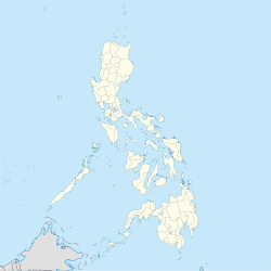
 Map o Metro Manila showin the location o Pasig | |
| Coordinates: 14°35′14″N 121°03′40″E / 14.58722°N 121.06111°ECoordinates: 14°35′14″N 121°03′40″E / 14.58722°N 121.06111°E | |
| Kintra | Philippines |
| Region | National Capital Region |
| Destrict | Lone District of Pasig City |
| Foondit | 1573 |
| Ceetyheid | 12 Januar 1995 |
| Barangays | 30 |
| Govrenment | |
| • Mayor | Maribel A. Eusebio (Nacionalista) |
| • Vice Mayor | Iyo Christian Caruncho Bernardo (Liberal) |
| • Sangguniang Panlungsod | Councilors
|
| Area | |
| • Total | 48.46 km2 (18.71 sq mi) |
| Population (2010)[3] | |
| • Total | 803,159 |
| • Density | 17,000/km2 (43,000/sq mi) |
| Demonym(s) | Pasigueño |
| Time zone | UTC+8 (PST) |
| ZIP code | see § Zip Codes |
| Aurie code | 02 |
| Website | pasigcity |
Pasig, offeecially the City of Pasig (Filipino: Lungsod ng Pasig) is ane o the heichlie urbanisit ceeties o Metro Manila in the Philippines. It wis the umwhile caipital o the province o Rizal prior tae the formation the Naitional Caipital Region.
Sister ceeties
[eedit | eedit soorce] Marikina, Philippines
References
[eedit | eedit soorce]- ↑ "Cities". Quezon City, Philippines: Department of the Interior and Local Government. Archived frae the original on 9 Mairch 2013. Retrieved 15 November 2012.
- ↑ "Province: NCR, SECOND DISTRICT". PSGC Interactive. Makati City, Philippines: National Statistical Coordination Board. Archived frae the original on 14 November 2013. Retrieved 22 November 2012.
- ↑ "Population and Annual Growth Rates for The Philippines and Its Regions, Provinces, and Highly Urbanized Cities" (PDF). 2010 Census and Housing Population. National Statistics Office. Archived frae the original (PDF) on 28 September 2013. Retrieved 7 November 2012.
Freemit airtins
[eedit | eedit soorce]| Wikimedia Commons haes media relatit tae Pasig City. |
