Clallam County, Washington
Appearance
Clallam County | |
|---|---|
 Clallam County Courthouse | |
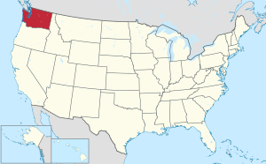
 Location within the U.S. state of Washington | |
 Washington's location within the U.S. | |
| Coordinates: 48°06′45″N 123°26′27″W / 48.1125°N 123.44083333333°W | |
| Country | |
| State | |
| Founded | April 26, 1854 |
| Seat | Port Angeles |
| Largest city | Port Angeles |
| Area | |
| • Total | 2,671 sq mi (6,920 km2) |
| • Land | 1,738 sq mi (4,500 km2) |
| • Water | 932 sq mi (2,410 km2) 35% |
| Population (2020) | |
| • Total | 77,155 |
| • Density | 44.4/sq mi (17.1/km2) |
| Time zone | UTC−8 (Pacific) |
| • Summer (DST) | UTC−7 (PDT) |
| Congressional district | 6th |
| Website | www |


Clallam County is a county in Washington in the United States. The county seat is Port Angeles. 77,155 people lived there at the 2020 census.[1]
The name Clallam means "the strong people" in Klallam.
References
[change | change source]- ↑ "QuickFacts: Clallam County, Washington". United States Census Bureau. Retrieved January 20, 2024.
